Tataháza
- Tataháza
-
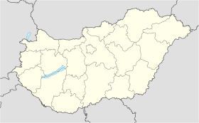
Tataháza est un village et une commune du comitat de Bács-Kiskun en Hongrie.
Géographie
Cette section est vide, insuffisamment détaillée ou incomplète.
Votre aide est la bienvenue !
Histoire
Cette section est vide, insuffisamment détaillée ou incomplète.
Votre aide est la bienvenue !
Catégorie :
- Ville et village du comitat de Bács-Kiskun
Wikimedia Foundation.
2010.
Contenu soumis à la licence CC-BY-SA. Source : Article Tataháza de Wikipédia en français (auteurs)
Regardez d'autres dictionnaires:
Tataháza — Infobox Settlement subdivision type = Country subdivision name = HUN timezone=CET utc offset=+1 timezone DST=CEST utc offset DST=+2 pushpin pushpin label position = pushpin map caption = Tataháza pushpin mapsize = official name=Tataháza… … Wikipedia
Tatahaza — Sp Tãtahaza Ap Tataháza L Vengrija … Pasaulio vietovardžiai. Internetinė duomenų bazė
Tataháza — Sp Tãtahaza Ap Tataháza L Vengrija … Pasaulio vietovardžiai. Internetinė duomenų bazė
Bács-Kiskun County — Infobox Hungarian county name =Bács Kiskun region =Southern Great Plain seat = Kecskemét area = 8,445 population = 534,000 density = 63 cities = 119Bács Kiskun is a county ( megye in Hungarian; IPA2|baːtʃ kiʃkun) located in southern Hungary. It… … Wikipedia
Kelebija — (Serbian: Келебија, Kelebija , Hungarian: Kelebia , Croatian: Kelebija , Bunjevac: Kelebija ) is a village close to Subotica in Serbia. It is situated in the municipality of Subotica, North Bačka District, Autonomous Province of Vojvodina. The… … Wikipedia
Csávoly — Csávoly … Wikipedia
Dunavecse — Coat of arms … Wikipedia
Plazović — The Plazović (Serbian Cyrillic: Плазовић) or Kiđoš ( hu. Kígyós; Serbian Cyrillic: Киђош), is a river in southern Hungary and northern Serbia. It flows entirely within the Bačka region, and during its 129 km long course, on a section of only 15… … Wikipedia
Dunapataj — Dunapataj … Wikipedia
Bócsa — Country Hungary County Bács Kiskun Area – Total 97.04 km2 (37.5 sq … Wikipedia


 Hongrie
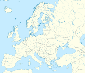

 Tataháza


