Tonbridge et Malling (borough)
- Tonbridge et Malling (borough)
-
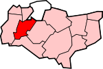
Tonbridge et Malling est un District non-métropolitain et Borough dans le Comté du Kent.
Le gouvernement local
Borough Article détaillé: Tonbridge et Malling conseil du Borough
Tonbridge & Malling à son conseil basé à Kings Hill, avec un bureau régional au Château de Tonbridge. Le borough est divisé à des fins politiques, en 26 Ward, dont sept dans la ville de Tonbridge (appelés Cage Green, Castle, Higham, Judd, Medway, Trench and Vauxhall Wards). En dehors de la ville, les conseillers servent les wards en couvrant les villages suivants ou groupes de villages, dont beaucoup ont aussi des conseils paroissiaux :
- Aylesfor
- Blue Bell Hill, & Walderslade
- Borough Green & Long Mill
- Burham, Wouldham et Eccles
- Ditton
- Downs
- East Malling,
- East Peckham & Golden Green
- Hadlow, Mereworth & West Peckham
- Hildenborough
- Ightham
- Kings Hill
- Larkfield - deux salles: le Nord et le Sud
- Snodland - deux salles: Est et Ouest
- Wateringbury
- West Malling & Leybourne
- Wrotham
Paroisses civiles
Le niveau inférieur du gouvernement local est la paroisse civile. En voici la liste :
- Addington
- Aylesford
- Birling
- Borough Green
- Burham
- Ditton
- East Malling et Larkfield
- East Peckham
- Hadlow
- Hildenborough
- Ightham
- Kings Hill
- Leybourne
- Mereworth
- Offham
- Platt
- Plaxtol
- Ryarsh
- Shipbourne
- Snodland
- Stansted
- Trottiscliffe
- Wateringbury
- West Malling
- West Peckham
- Wouldham
Catégorie :
- District non-métropolitain du Kent
Wikimedia Foundation.
2010.
Contenu soumis à la licence CC-BY-SA. Source : Article Tonbridge et Malling (borough) de Wikipédia en français (auteurs)
Regardez d'autres dictionnaires:
Tonbridge and Malling — is a local government district and borough in the English county of Kent.Tonbridge and Malling borough covers an area from the North Downs at Burham and Snodland in the north to the town of Tonbridge in the south. The River Medway flows in a… … Wikipedia
Tonbridge and Malling (UK Parliament constituency) — UK constituency infobox Name = Tonbridge and Malling Map1 = TonbridgeMalling Map2 = Kent Entity = Kent Type = County Year = 1974 County =Kent EP = South East England MP = John Stanley Party = ConservativeTonbridge and Malling is a constituency… … Wikipedia
Tonbridge and Malling — Borough of Tonbridge and Malling Lage in Kent Status Borough Region South East England Verw.grafschaft Kent … Deutsch Wikipedia
Tonbridge and Malling — ▪ district, England, United Kingdom borough (district), administrative and historic county of Kent, England, on the River Medway southeast of London. It lies to the south of the North Downs and northeast of the Weald in west central Kent.… … Universalium
Tonbridge School — Not to be confused with Tonbridge Grammar School. Tonbridge School Motto Deus Dat Incrementum (God Giveth the Increase) Established 1553 Type public school … Wikipedia
Tonbridge — infobox UK place country = England official name= Tonbridge static static image caption=Tonbridge Castle latitude= 51.1987 longitude= 0.2764 population = 30,340 (2007) shire district= Tonbridge and Malling shire county = Kent region= South East… … Wikipedia
Borough Green — infobox UK place country = England official name= Borough Green latitude= 51.291300 longitude= 0.306200 population = shire district= Tonbridge and Malling shire county = Kent region= South East England constituency westminster= Tonbridge and… … Wikipedia
Tonbridge railway station — Infobox UK station name = Tonbridge code = TON manager = Southeastern locale = Tonbridge borough = Tonbridge and Malling years = 26 May 1842 events = Opened as Tunbridge years1 = January 1852 events1 = Renamed (Tunbridge Junction) years2 = 1864… … Wikipedia
Borough Green & Wrotham railway station — Infobox UK station name = Borough Green Wrotham code = BRG manager = Southeastern locale = Borough Green borough = Tonbridge and Malling usage0405 = 0.381 usage0506 = 0.394 usage0607 = 0.420 platforms = 2 start = 1 June 1874Borough Green Wrotham… … Wikipedia
Oast Theatre, Tonbridge — Coordinates: 51°12′21″N 0°15′44″E / 51.2059°N 0.2623°E / 51.2059; 0.2623 … Wikipedia