Trijebanj

Trijebanj

43° 09′ 57″ N 17° 53′ 15″ E / 43.1658, 17.8875

Trijebanj
Administration
Pays Drapeau de Bosnie-Herzégovine Bosnie-Herzégovine
Entité Drapeau de la Fédération de Bosnie-et-Herzégovine Fédération de Bosnie-et-Herzégovine
Canton Herzégovine-Neretva
Municipalité Stolac
Géographie
Coordonnées 43° 09′ 57″ Nord
       17° 53′ 15″ Est
/ 43.1658, 17.8875
Démographie
Population 352 hab. (1991)
Localisation
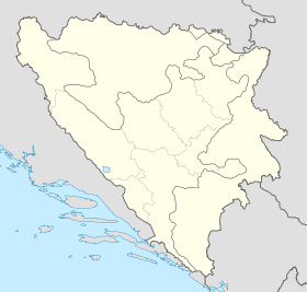
Bosnia and Herzegovina location map.svg
City locator 15.svg
Trijebanj

Trijebanj (en cyrillique : Тријебањ) est un village de Bosnie-Herzégovine. Il est situé dans la municipalité de Stolac et dans le canton d'Herzégovine-Neretva, Fédération de Bosnie-et-Herzégovine. Au recensement de 1991, il comptait 352 habitants, dont une majorité de Croates[1].

Sommaire

Démographie

Répartition de la population (1991)

Nationalité Nombre %
Croates 184 52,27
Musulmans 113 32,10
Serbes 52 14,77
Yougoslaves 3 0,85[1]

Notes et références

  1. a et b (bs)(hr)(sr) Livre : Composition nationale de la population - Résultats de la République par municipalités et localités 1991, Bulletin statistique n°234, Publication de l'Institut national de statistique de Bosnie-Herzégovine, Sarajevo.

Voir aussi

Articles connexes

Lien externe


Wikimedia Foundation. 2010.

Contenu soumis à la licence CC-BY-SA. Source : Article Trijebanj de Wikipédia en français (auteurs)

Игры ⚽ Поможем сделать НИР

Regardez d'autres dictionnaires:

  • Stolac — Pour les articles homonymes, voir Stolac (homonymie). 43° 05′ 04″ N 17° 57′ 27″ E …   Wikipédia en Français

  • Stolac — Infobox Settlement official name = PAGENAME settlement type = subdivision type = Country subdivision name = BIH timezone=CET utc offset=+1 map caption =Location of PAGENAME within Bosnia and Herzegovina. timezone DST=CEST utc offset DST=+2… …   Wikipedia

  • List of settlements in Bosnia and Herzegovina — This is a complete list of settlements in Bosnia and Herzegovina, as recorded by 1991 census, sorted by municipalities. Town of Sarajevo = Sarajevo Centar = • Mrkovići • Nahorevo• Poljine• Radava• Sarajevo (part of settlement)• Vića Sarajevo… …   Wikipedia

  • List of settlements in the Federation of Bosnia and Herzegovina/T — Ta Tasovčići, Te Tepčići, Teskera, Tešanj Ti Tihaljina, Tinje To Tošćanica (municipality Prozor Rama), Tovarnica Tr Travnik, Trebeševo, Trebimlja (municipality Ravno), Trebižat, Treboje, Trešnjevica, Trge, Tribistovo, Trijebanj (municipality… …   Wikipedia

  • Stolac (Neretva-Herzegovine) — Stolac Pour les articles homonymes, voir Stolac (homonymie). Stolac Столац [[Image:|100px|center|Blason]] [[Image:|100px|center|Drapeau]] Blaso …   Wikipédia en Français

  • Aladinići — 43° 07′ 10″ N 17° 51′ 28″ E / 43.1194, 17.8578 …   Wikipédia en Français

  • Barane (Stolac) — Pour les articles homonymes, voir Barane. 43° 06′ 48″ N 17° 57′ 16″ E …   Wikipédia en Français

  • Bjelojevići (Stolac) — Pour les articles homonymes, voir Bjelojevići. 43° 01′ 05″ N 17° 52′ 01″ E …   Wikipédia en Français

  • Borojevići (Stolac) — Pour les articles homonymes, voir Borojevići. 43° 06′ 09″ N 17° 53′ 52″ E …   Wikipédia en Français

  • Burmazi — 43° 01′ 33″ N 17° 55′ 58″ E / 43.0258, 17.9328 …   Wikipédia en Français

Share the article and excerpts

Direct link
Do a right-click on the link above
and select “Copy Link”