Val Rita-Harty
- Val Rita-Harty
-
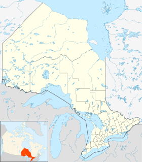
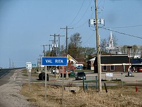
Val Rita-Harty est un canton franco-ontarien situé dans le district de Cochrane dans la province de l'Ontario au Canada.
Au dernier recensement de la population de 2006, le nombre d'habitants s'élevait à 940 personnes dont 795 Francophones et 145 Anglophones.
Liens externes
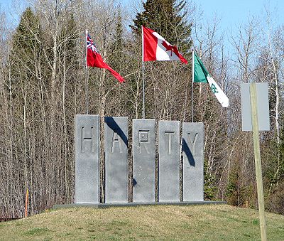
Drapeaux à l'entrée de la ville de Harty
(de gauche à droite : Ontario, Canada et Franco-Ontarien)
Wikimedia Foundation.
2010.
Contenu soumis à la licence CC-BY-SA. Source : Article Val Rita-Harty de Wikipédia en français (auteurs)
Regardez d'autres dictionnaires:
Val Rita-Harty, Ontario — Infobox Settlement official name = Township of Val Rita Harty native name = nickname = motto = imagesize = image caption = Val Rita image image dot dot mapsize = dot map caption = mapsize = map caption = subdivision type = Country subdivision… … Wikipedia
Mattice-Val Côté, Ontario — Township of Mattice Val Côté Voyageur statue in Mattice. Bridge over the Missinaibi River is in the background … Wikipedia
Cochrane District municipal elections, 2010 — Elections were held in the organized municipalities in the Cochrane District of Ontario on October 25, 2010 in conjunction with municipal elections across the province. Contents 1 Black River Matheson 2 Cochrane 3 Fauquier Strickland … Wikipedia
Opasatika, Ontario — Township of Opasatika Highway 11 through Opasatika. Country … Wikipedia
Black River-Matheson, Ontario — Township of Black River Matheson Township … Wikipedia
Northern Ontario — Region ██ Core area ██ Extended area Country … Wikipedia
Moosonee, Ontario — Moosonee Town … Wikipedia
Cochrane, Ontario — Coordinates: 49°04′N 81°01′W / 49.067°N 81.017°W / 49.067; 81.017 … Wikipedia
Cochrane District, Ontario — is a district and census division in Northeastern Ontario in the Canadian province of Ontario. It was created in 1921 from parts of Timiskaming and Thunder Bay districts. The land area of this district is 141,244 km² (54,522 mi²).… … Wikipedia
Iroquois Falls, Ontario — Iroquois Falls Town Iroquois Falls municipal office … Wikipedia
 Canada
 Ontario