Birjand
- Birjand
-
32° 53′ N 59° 13′ E / 32.88, 59.22
Birjand (en persan : بيرجند) est la capitale de la province du Khorasan du sud située à l'est de l'Iran, connue pour ses exports de safran et de tapis faits à la main.
Elle avait une population estimée à 183 010 habitants en 2005.[1]
Étant proche de la frontière avec l'Afghanistan, Birjand est située sur la "Route de la soie" de l'opium qui est introduit en Iran avant de poursuivre sa route vers l'Europe. (la région est aussi appelée "croissant de l'opium")
Le premier réseau de distribution d'eau urbain en Iran a été installé à Birjand.
L'école Shokatiyeh à Birjand, avec l'école Dar-ol Fonoun à Téhéran furent les premières écoles publiques en Iran.
Notables originaires de Birjand
- Shah Seyyed Ali Kazemi, dernier prince de Mud et Birjand du trône du paon (lié au Premier ministre Alam, sa femme et le Shah Reza Pahlavi
- prince héritier de Birjand Marcel Kasemi
- Dr. Asadollah Alam, Premier Ministre
Voir aussi
Universités
Liens externes
Birjand:
Wikimedia Foundation.
2010.
Contenu soumis à la licence CC-BY-SA. Source : Article Birjand de Wikipédia en français (auteurs)
Regardez d'autres dictionnaires:
Birjand — Saltar a navegación, búsqueda Birjand Bandera … Wikipedia Español
Birjand — Infobox City official name = Birjand native name = nickname = Storm city motto = imagesize = image caption = image mapsize = map caption = pushpin pushpin label position = pushpin map caption = pushpin mapsize = subdivision type = subdivision… … Wikipedia
Birjand — Birdschand DEC … Deutsch Wikipedia
Bīrjand — ▪ Iran town, eastern Iran, built on low hills in a barren valley 4,774 feet (1,455 metres) above sea level. The town, divided by the Khūsf River (usually dry), was formerly the seat of semi independent rulers and a caravan centre; it has in … Universalium
Birjand — Original name in latin Brjand Name in other language Birdjand, Birdzhend, Birjand, Brjand, byrjnd, shhrstan byrjnd, Бирдженд, Бранд State code IR Continent/City Asia/Tehran longitude 32.86628 latitude 59.22114 altitude 1459 Population 196982 Date … Cities with a population over 1000 database
Birjand County — ( fa. شهرستان بیرجند) is a county in South Khorasan province, Iran. The capital of the county is Birjand.References* اطلس گیتاشناسی استانهای ایران [Atlas Gitashenasi Ostanhai Iran] ( [http://www.gitashenasi.com/En/Product/Index.cfm?I=9… … Wikipedia
Birjand University of Medical Sciences — Infobox University name=Birjand University of Medical Sciences native name=دانشگاه علوم پزشکی و خدمات بهداشتی درمانی بيرجند established=1985 type=Public city=Birjand state=South Khorasan Province country=Iran president = Morad Hashem Zehi, M.D.… … Wikipedia
Birjand Airport — Infobox Airport name = Birjand Airport nativename = nativename a = nativename r = image width = caption = IATA = XBJ ICAO = OIMB type = Public owner = operator = city served = location = Birjand elevation f = 4,952 elevation m = 1,509 coordinates … Wikipedia
Birjand — Birjạnd [ dʒ ], Stadt in Ostiran, Birdjand … Universal-Lexikon
University of Birjand — Infobox University name=University of Birjand دانشگاه بیرجند motto= established=1975 type=Public city=Birjand state=South Khorasan Province country=Iran president=Dr. Miri undergrad=5,000 postgrad=? postgrad label=graduate faculty= campus=Urban… … Wikipedia

 Iran
Iran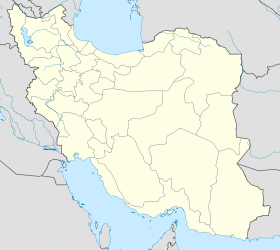
 Birjand
