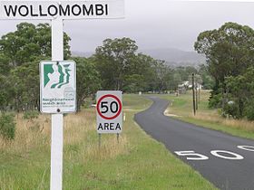
Wollomombi
Contenu soumis à la licence CC-BY-SA. Source : Article Wollomombi de Wikipédia en français (auteurs)
Regardez d'autres dictionnaires:
Wollomombi River — Mündung des Wollomombi River (links) in den Chandler RiverVorlage:Infobox Fluss/KARTE fehlt … Deutsch Wikipedia
Wollomombi Cottage — (Wollomombi,Австралия) Категория отеля: Адрес: Village Road, 2350 Wollomombi, Ав … Каталог отелей
Wollomombi Falls — (pronounced walla mom bee ), from an Aboriginal word, are located in the Oxley Wild Rivers National Park, 40 km due East of Armidale, New South Wales and 1 km off the Waterfall Way. They are located on the Wollomombi River, a tributary of Macleay … Wikipedia
Wollomombi Falls — ▪ waterfall, New South Wales, Australia set of two cataracts on the Wollomombi River, a headstream of the Macleay River, in northeastern New South Wales, Australia. The falls are situated 22 miles (35 km) east of Armidale in the New England … Universalium
Wollomombi Falls — /wɒləˈmʌmbi/ (say woluh mumbee) plural noun a waterfall on the escarpment of the New England plateau, east of Armidale, NSW. About 220 m …
Cataratas del Wollomombi — Saltar a navegación, búsqueda Vista del desfiladero del Wollomombi desde el mirador de Edgar. Las cataratas del Wollomombi, cuyo nombre proviene de una palabra aborigen, se encuentran en el Parque Nacional de Aguas Salvajes de Oxley (Oxley Wild… … Wikipedia Español
Oxley Wild Rivers National Park — Oxley Wild Rivers IUCN Category Ib (Wilderness Area) Apsley Falls, Walcha, NSW showing one of several lookouts Nearest town/city Walcha … Wikipedia
Chandler River (New South Wales) — Chandler River Halls Peak Mine und Chandler River im Oxley Wild Rivers NationalparkVorlage:Infobox Fluss/KARTE fehlt … Deutsch Wikipedia
Chandler River (New South Wales) — Chandler River Halls Peak Mine and the Chandler River in Oxley Wild Rivers National Park Origin New South Wales Basin countries … Wikipedia
Waterfall Way — Infobox Australian Road road name = Waterfall Way route route route photo = Dangar Falls Dorrigo.jpg caption = Dangar Falls at Dorrigo length = 165 direction = West East start = finish = est = through = Ebor, Dorrigo, Bellingen route = exits =… … Wikipedia
 Wollomombi
 Australie
 Wollomombi