Youbou
- Youbou
-
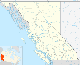
Youbou est une communauté de la Colombie-Britannique située sur l'île de Vancouver.
Histoire
La communauté de Youbou est née en 1907 quand N. Falconer et A. J. Coasts, deux transporteurs de bois travaillant pour l’American Finance Company, arrivèrent à cet endroit. Cette compagnie, plus tard appelée Empire Lumber Company, assurèra que le chemin de fer Esquimalt & Nanaimo serait bientôt construit, assurèrent de grandes terres de bois incluant le moulin et le lieu du village. Ces garanties furent conclues en 1909.
Le chemin de fer Esquimalt & Nanaimo arriva en 1912 et l’Empire Lumber Company commença à établir des camps. De l'équipement moderne fut acheminé et la transport du bois fut sur pied en 1913. Un petit moulin fut construit à Cottonwood, comme Youbou était connue à l'origine.
Lien externe
Site officiel
Catégorie :
- Communauté de Colombie-Britannique
Wikimedia Foundation.
2010.
Contenu soumis à la licence CC-BY-SA. Source : Article Youbou de Wikipédia en français (auteurs)
Regardez d'autres dictionnaires:
Youbou, British Columbia — Youbou is a community located on the north shore of Cowichan Lake, west of Duncan and a 25 minute drive west of the community of Lake Cowichan, Canada. The former mill town provides a public beach and extensive recreational opportunities,… … Wikipedia
Cavalla River — Youbou redirects here. For the small town in western Canada, see Youbou, British Columbia. The Cavalla River (also known as Cavally, Youbou or Diougou river) is a river in West Africa running from north of Mount Nimba in Guinea, through Côte d… … Wikipedia
Lake View Holiday Home — (Youbou,Канада) Категория отеля: Адрес: 10215 Youbou Road, V0R 3E1 Youbou, К … Каталог отелей
British Columbia Highway 18 — Infobox road province=BC type=Hwy route=18 maint= length km= length round= length ref= established= direction a= starting terminus= junction= direction b= ending terminus= previous type=Hwy previous route=17A next type=Hwy next route=19Highway 18 … Wikipedia
Cowichan Valley Regional Transit System — Comox Valley Transit System Headquarters 5280 Polkey Road[1] Duncan, British Columbia Service area Cowichan Valley … Wikipedia
Cavally — 4° 21′ 54″ N 7° 31′ 46″ W / 4.365, 7.52944 … Wikipédia en Français
Victoria, British Columbia — For other uses, see Victoria (geographical disambiguation). This article is about the city of Victoria. For electoral districts with the name Victoria, or in the area of Greater Victoria, see Victoria (electoral districts). City of Victoria… … Wikipedia
Vancouver Island — Infobox Islands name = Vancouver Island image caption = image size = locator Location map|Canada British Columbia|lat=49.798287|long= 126.123047|marksize=16 map custom = yes native name = native name link = nickname = location = Pacific Ocean… … Wikipedia
List of communities in British Columbia — This is a list of communities in British Columbia, a province in Canada. For the purposes of this list, a community is defined as either an incorporated municipality (including Indian reserves), or an unincorporated settlement inside or outside… … Wikipedia
Nanaimo — For other uses, see Nanaimo (disambiguation). City of Nanaimo Nanaimo … Wikipedia
 Canada
 Colombie-Britannique