Bláskógabyggð
- Bláskógabyggð
-
64° 16′ 35″ N 20° 24′ 03″ W / 64.2764, -20.4009
Bláskógabyggð
Politique (2010-2014)
| Maire |
Valtýr Valtýsson |
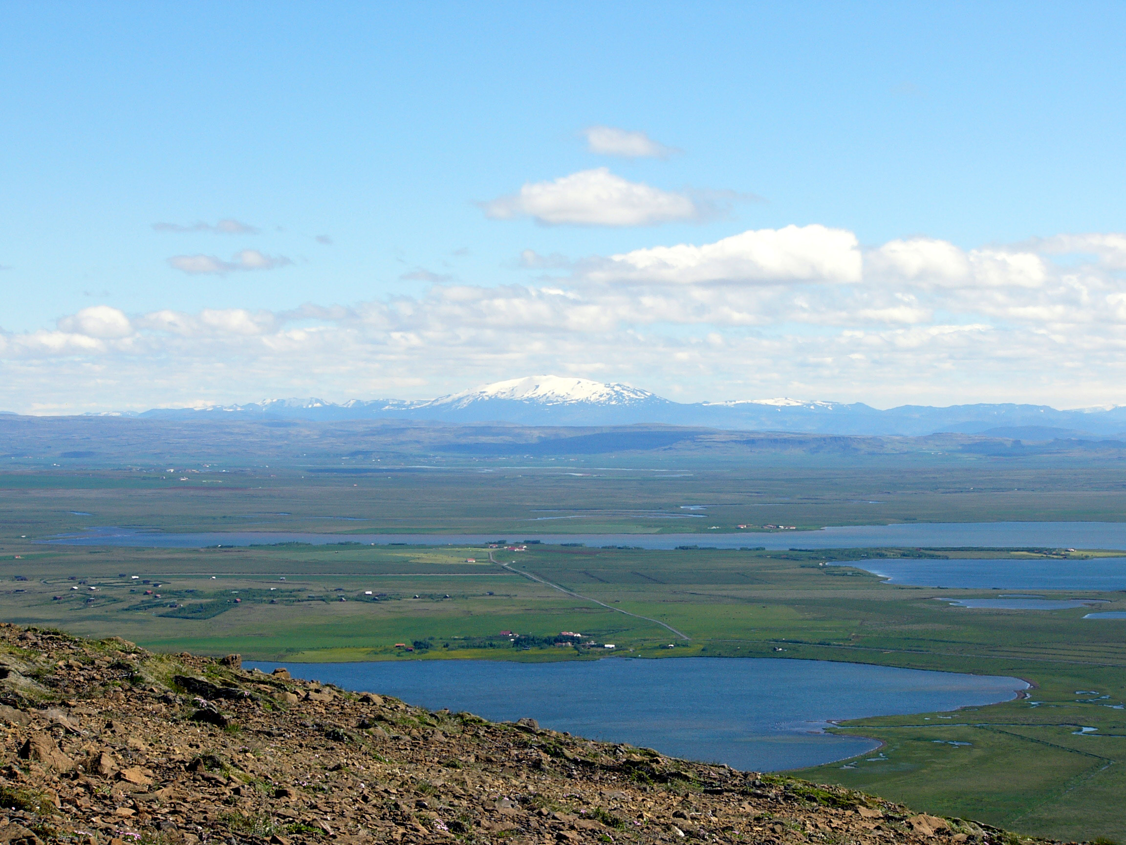
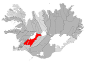
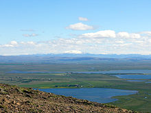
Bláskógabyggð est une municipalité située à l'ouest de l'Islande, à l'intérieur des terres.
Histoire
Cette section est vide, insuffisamment détaillée ou incomplète.
Votre aide est la bienvenue !
Composition
Cette section est vide, insuffisamment détaillée ou incomplète.
Votre aide est la bienvenue !
Compétence
Cette section est vide, insuffisamment détaillée ou incomplète.
Votre aide est la bienvenue !
Démographie
Cette section est vide, insuffisamment détaillée ou incomplète.
Votre aide est la bienvenue !
Wikimedia Foundation.
2010.
Contenu soumis à la licence CC-BY-SA. Source : Article Bláskógabyggð de Wikipédia en français (auteurs)
Regardez d'autres dictionnaires:
Bláskógabyggð — is a municipality located in western Iceland, and is situated fully inland. As of December 1, 2007, it had a total population of approximately 1000. The total area is 3300 km².External links* http://www.blaskogabyggd.is/ … Wikipedia
Bláskógabyggð — Gemeinde Bláskógabyggð Basisdaten Staat: Island Region: Suðurland Wahlkreis: Suðurkjördæmi Sýsla: Ár … Deutsch Wikipedia
Blaskogabyggd — Gemeinde Bláskógabyggð Basisdaten Staat: Island Region: Suðurland Wahlkreis: Suðurkjördæmi Sýsla … Deutsch Wikipedia
Städte in Island — Karte von Island Die Liste der Städte in Island bietet einen Überblick über die Entwicklung der Einwohnerzahl der größeren städtischen Siedlungen in Island. Aufgeführt ist auch eine alphabetische Liste aller bewohnten städtischen Siedlungen des… … Deutsch Wikipedia
Communes d'Islande — Liste des communes d Islande, par ordre alphabétique. Les communes islandaises sont regroupées pour former les 76 municipalités de l Islande. Commune Municipalité Population Année de la population Akranes Akranes 6 623 2011 Akureyri Akur … Wikipédia en Français
Liste der Städte in Island — Karte von Island Die Liste der Städte in Island bietet einen Überblick über die Entwicklung der Einwohnerzahl der größeren städtischen Siedlungen in Island. Aufgeführt ist auch eine alphabetische Liste aller bewohnten städtischen Siedlungen des… … Deutsch Wikipedia
Municipalities of Iceland — Lower level municipality map of Iceland The municipalities of Iceland are local administrative areas in Iceland that provide a number of services to their inhabitants such as kindergartens, elementary schools, waste management, social services,… … Wikipedia
Arborg — Gemeinde Árborg (Sveitarfélagið Árborg) Basisdaten Staat: Island Region: Suðurland … Deutsch Wikipedia
Asahreppur — Ásahreppur Basisdaten Staat: Island Region: Suðurland Wahlkreis: Suðurkjördæmi Sýsla … Deutsch Wikipedia
Eyrarbakki — Gemeinde Árborg (Sveitarfélagið Árborg) Basisdaten Staat: Island Region: Suðurland … Deutsch Wikipedia


 Islande