Cahir
- Cahir
-
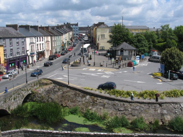
Située à 15 kilomètres du Rock of Cashel et à 20 kilomètres de Clonmel, dans le comté de Tipperary, Cahir (Cathair Dún Iascaigh, « le Fort en pierre du poisson ») est une petite ville irlandaise de 5000 habitants environ.
Histoire
Cahir était à l'origine un village médiéval dominé par la famille des Butler. Ceux-ci ont d'ailleurs bâti le château de Cahir, un des plus anciens châteaux encore en état en Irlande. Ils sont également à l'origine du Swiss Cottage, une demeure bourgeoise dans le plus pur style anglais du début du XIXe siècle, à deux kilomètres du centre-ville. La ville comporte également une vieille église anglicane, une autre en ruines ainsi qu'un prieuré lui aussi en ruines.
Le château de Cahir a été utilisé en 1980 pour les besoins du tournage d'Excalibur de John Boorman.
Voir aussi
Wikimedia Foundation.
2010.
Contenu soumis à la licence CC-BY-SA. Source : Article Cahir de Wikipédia en français (auteurs)
Regardez d'autres dictionnaires:
Cahir — (irisch: An Chathair, das bedeutet so viel wie „Steinfort“ oder Dun), früher auch Caher geschrieben, ist eine Stadt mit 3.381 Einwohnern (2006) am Fluss Suir im County Tipperary in der Republik Irland. Seine Lage an der Kreuzung der N8 und der… … Deutsch Wikipedia
Cahir — m Irish: Anglicized spelling of CATHAOIR (SEE Cathaoir) … First names dictionary
Cahir — Infobox Irish Place name = Cahir gaeilge = Cathair Dun Iascaigh crest motto = map pin coords = left: 47px; top: 99px north coord = 52.385868 west coord = 7.921658 irish grid = S051252 area = elevation = province = Munster county = County… … Wikipedia
Cahir — Original name in latin Cahir Name in other language An Chathair, Caher, Cahir, n Chathair State code IE Continent/City Europe/Dublin longitude 52.37694 latitude 7.92167 altitude 56 Population 3057 Date 2011 05 25 … Cities with a population over 1000 database
Cahir Castle — ( ga. Caisleán na Cathrach), one of the largest castles in Ireland, was built in County Tipperary in 1142 by Conor O Brien, Prince of Thomond, on an island in the river Suir. Now situated in the town centre, the castle is well preserved and has… … Wikipedia
Cahir House Hotel (Tipperary County) — Cahir House Hotel country: Ireland, city: Tipperary County (Cahir) Cahir House Hotel Set like a jewel in the centre of the heritage town of Cahir, the Cahir House Hotel offers its visitors an opportunity to enjoy modern comforts with old world… … International hotels
Cahir House Hotel — (Cahir,Ирландия) Категория отеля: 3 звездочный отель Адрес: The Square, Cahir, Ирландия … Каталог отелей
Cahir Castle — (teilweise auch Caher Castle, irisch Caisleán na Cathrach ) ist eine Burg in Cahir, Castle Street, im County Tipperary, Irland. Inhaltsverzeichnis 1 G … Deutsch Wikipedia
Cahir railway station — Cahir railway station, opened on 1 May 1852 [cite web | title=Cahir station | work=Railscot Irish Railways | url=http://www.railscot.co.uk/Ireland/Irish railways.pdf | accessdate=2007 09 07] , serves the town of Cahir in County Tipperary, Ireland … Wikipedia
Cahir GAA — is the Gaelic Athletic Association club for the parish of Cahir.It s dominant sport is Gaelic football but it also fields Hurling teams in various age groups. Football The Cahir Senior Football panel competes in the South and Counties A divisions … Wikipedia