Caroebe

Caroebe
Caroebe
Armoiries
Blason de Caroebe
logo
Drapeau de Caroebe
Surnom : Cidade porto (Ville port)
Administration
Pays Drapeau : Brésil Brésil
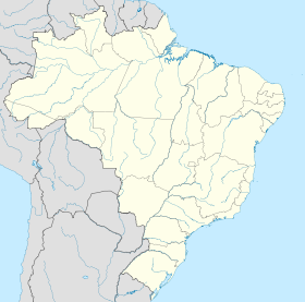
Région Nord
État Roraima Roraima
Maire Arnaldo Muniz de Souza (PR)
Code postal 69 378-000
Démographie
Population 7 086 hab. (IBGE 01-04-2007)
Densité 0,59 hab./km²
Gentilé Caroebense
Géographie
Coordonnées 0° 53′ 01″ N 59° 41′ 47″ W / 0.88357, -59.696470° 53′ 01″ Nord
       59° 41′ 47″ Ouest
/ 0.88357, -59.69647
  
Altitude 135 m
Superficie 12 066 km2
Informations
Fondateur Date de fondation Loi n° 082 4 novembre 1994
Fuseau horaire Heure d'été UTC-4 UTC-4
Indicatif téléphonique 95
Centres d'intérêts
Écotourisme
Localisation de Caroebe
Localisation de Caroebe sur une carte
Voir la carte administrative
City locator 14.svg
Voir la carte topographique
City locator 14.svg

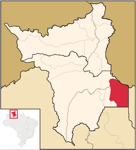
Caroebe est une ville brésilienne du sud-est de l'État du Roraima. Sa population était estimée à 7 086 habitants en 2007. La municipalité s'étend sur 12 066 km².

État du Roraima, Nord
Portal.svg Portail — Géographie, Histoire, Sport
Roraima, Brésil Drapeau du Roraima Drapeau du Brésil

Wikimedia Foundation. 2010.

Contenu soumis à la licence CC-BY-SA. Source : Article Caroebe de Wikipédia en français (auteurs)

Игры ⚽ Нужно сделать НИР?

Regardez d'autres dictionnaires:

  • Caroebe — is a municipality located in the southeast of the state of Roraima in Brazil. Its population is 5,869 and its area is 12,066 km² …   Wikipedia

  • Caroebe — Admin ASC 2 Code Orig. name Caroebe Country and Admin Code BR.25.1400233 BR …   World countries Adminstrative division ASC I-II

  • Roraima — 2° 03′ N 61° 24′ W / 2.05, 61.4 …   Wikipédia en Français

  • Муниципалитеты штата Рорайма — …   Википедия

  • Кароэби — Муниципалитет Кароэби Caroebe Флаг Герб …   Википедия

  • Mucajaí — Coordinates: 02°25′48″N 60°54′00″W / 2.43°N 60.9°W / 2.43; 60.9 …   Wikipedia

  • Normandia, Roraima — Coordinates: 03°52′51″N 59°37′22″W / 3.88083°N 59.62278°W / 3.88083; 59.62278 Normandia is a municipality …   Wikipedia

  • History of Roraima — The history of the territory that is now Roraima, a state at the extreme north of present day Brazil is recent, but not thereby simple. Invaded numerous times by the various countries interested in the region, the seldom visited Roraima arose… …   Wikipedia

  • Liste der Gemeinden in Roraima — Die untenstehenden Gemeinden liegen im brasilianischen Bundesstaat Roraima. Die Zahl hinter den Namen ist die Bevölkerung im Gemeindegebiet in einer Schätzung des brasilianischen Bundesamtes für Statistik und Geographie (IBGE) für den 1. Juli… …   Deutsch Wikipedia

  • Liste Des Villes Du Roraima — Liste des villes de l État du Roraima, au Brésil. L État compte 15 municipalités (municípios en portugais) …   Wikipédia en Français

Share the article and excerpts

Direct link
Do a right-click on the link above
and select “Copy Link”