Cattenbroek

Cattenbroek

52°3′50″N 4°56′20″E / 52.06389, 4.93889

Cattenbroek
Administration
Pays Drapeau : Pays-Bas Pays-Bas
Province Utrecht
Commune Montfoort
Géographie
Population ? hab. (?)
Autres informations
Code postal
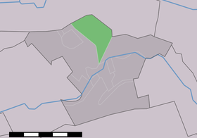
Localisation de Cattenbroek dans la commune de Montfoort

Cattenbroek est un hameau situé dans la commune néerlandaise de Maarssen, dans la province d'Utrecht.


Wikimedia Foundation. 2010.

Contenu soumis à la licence CC-BY-SA. Source : Article Cattenbroek de Wikipédia en français (auteurs)

Игры ⚽ Поможем сделать НИР

Regardez d'autres dictionnaires:

  • Cattenbroek — Dutch town locator maps mun town caption = Cattenbroek in the municipality of Montfoort.Cattenbroek (coord|52|4|N|4|56|E|type:city(80)) is a village in the Dutch province of Utrecht. It is a part of the municipality of Montfoort, and lies about 4 …   Wikipedia

  • Montfoort — Gemeinde Montfoort Flagge Wappen Provinz Utrecht Bürgermeister …   Deutsch Wikipedia

  • Achthoven (Utrecht) — 52°3′22″N 4°59′39″E / 52.05611, 4.99417 …   Wikipédia en Français

  • Linschoten (Utrecht) — 52°3′46″N 4°54′52″E / 52.06278, 4.91444 …   Wikipédia en Français

  • Montfoort — Héraldique …   Wikipédia en Français

  • Montfoortse Vaart — Vur sur le Montfoortse Vaart Caractéristiques Histoire Année d ouverture 1617 …   Wikipédia en Français

  • Willeskop — 52°1′27″N 4°54′5″E / 52.02417, 4.90139 …   Wikipédia en Français

Share the article and excerpts

Direct link
Do a right-click on the link above
and select “Copy Link”