De Houtigehage
Contenu soumis à la licence CC-BY-SA. Source : Article De Houtigehage de Wikipédia en français (auteurs)
Regardez d'autres dictionnaires:
Houtigehage — 53°9′14″N 6°8′41″E / 53.15389, 6.14472 … Wikipédia en Français
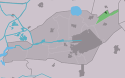
Smallingerland — Infobox Settlement official name = Smallingerland mapsize = 280px subdivision type = Country subdivision name = Netherlands subdivision type1 = Province subdivision name1 = Friesland area footnotes = (2006) area total km2 = 126.15 area land km2 … Wikipedia
Smallingerland — Gemeinde Smallingerland Flagge Wappen Provinz Friesland … Deutsch Wikipedia
Boarnburgum — Boornbergum 53°5′2″N 6°2′44″E / 53.08389, 6.04556 … Wikipédia en Français
Boornbergum — 53°5′2″N 6°2′44″E / 53.08389, 6.04556 … Wikipédia en Français
De Feanhoop — De Veenhoop 53°5′49″N 5°56′59″E / 53.09694, 5.94972 … Wikipédia en Français
De Pein — Opeinde 53°7′59″N 6°3′23″E / 53.13306, 6.05639 … Wikipédia en Français
De Tike — 53°9′7″N 6°2′13″E / 53.15194, 6.03694 … Wikipédia en Français
De Veenhoop — 53°5′49″N 5°56′59″E / 53.09694, 5.94972 … Wikipédia en Français
De Wilgen — 53°06′N 6°02′E / 53.1, 6.033 … Wikipédia en Français
 Pays-Bas
 Portail des Pays-Bas