Dunedoo
- Dunedoo
-
Dunedoo (836 habitants) est un village du centre de la Nouvelle-Galles-du-Sud, à 348 km de Sydney par la route sur la Golden Highway.
Le nom de la ville est d'origine aborigène et signifie "cygne noir", oiseau que l'on trouve facilement dans la région.
Référence
Liens externes
Wikimedia Foundation.
2010.
Contenu soumis à la licence CC-BY-SA. Source : Article Dunedoo de Wikipédia en français (auteurs)
Regardez d'autres dictionnaires:
Dunedoo — Original name in latin Dunedoo Name in other language Dunedoo State code AU Continent/City Australia/Sydney longitude 32.01634 latitude 149.3871 altitude 384 Population 1654 Date 2012 02 28 … Cities with a population over 1000 database
Dunedoo, New South Wales — Dunedoo New South Wales Dunedoo Hotel … Wikipedia
Castlereagh Highway — Infobox Australian Road road name = Castlereagh Highway route route route photo = caption = Proposed .] length = 781 direction = North South start = finish = est = through = Dirranbandi, Hebel, Walgett, Coonamble, Gulargambone, Gilgandra,… … Wikipedia
Castlereagh Highway — Straßenverlauf Dick O Brien Bridge (1991) über den … Deutsch Wikipedia
John Murphy (Australian politician) — John Paul Murphy (born 31 May 1950), Australian politician, has been an Australian Labor Party member of the Australian House of Representatives since October 1998, representing the Division of Lowe, New South Wales. He was born in Dunedoo, New… … Wikipedia
Talbragar River — The Talbragar River is a river in New South Wales, Australia. It starts on the western side of the Liverpool Range near Cassilis and flows west to join the Macquarie River near Dubbo. The Talbragar does not start in a high rainfall area and is… … Wikipedia
Golden Highway — Infobox Australian Road road name = Golden Highway route route route photo = GoldenHighwayBylongTurnoff.jpg caption = length = 314 direction = East West start = finish = est = through = Mount Thorley, Jerrys Plains, Denman, Sandy Hollow, Merriwa … Wikipedia
Gwabegar railway line, New South Wales — The Gwabegar railway line is a railway line in the west of New South Wales, Australia which passes through the town of Mudgee to Gulgong and eventually heads to Gwabegar. The section from Wallerawang to Capertee was opened on 15 May, 1882; the… … Wikipedia
Brian Johnston (rugby league) — Infobox rugby league biography playername = Brian Johnston fullname = Brian Stuart Johnston caption = position = rlp|CE dateofbirth = birth year and age|1958 placeofbirth = Dunedoo countryofbirth = Australia height = weight = club1 =… … Wikipedia
Birriwa, New South Wales — Infobox Australian Place | type = town name = Birriwa state = nsw caption = lga = Mid Western Regional Council postcode = 2844 est = pop = pop footnotes= elevation= elevation footnotes= maxtemp = mintemp = rainfall = stategov = Orange fedgov =… … Wikipedia
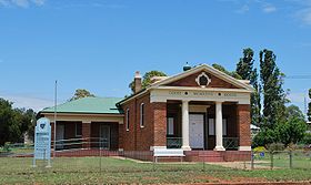 Le palais de justice de Dunedoo
 Australie
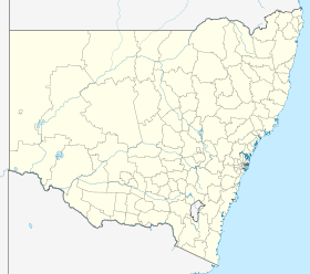
 Dunedoo