Earlsfield
- Earlsfield
-
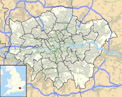
Earlsfield est un quartier de la banlieue sud de Londres localisé dans le district de Wandsworth.
Wikimedia Foundation.
2010.
Contenu soumis à la licence CC-BY-SA. Source : Article Earlsfield de Wikipédia en français (auteurs)
Regardez d'autres dictionnaires:
Earlsfield — infobox UK place country = England map type = Greater London region= London population= official name= Earlsfield latitude= 51.4439 longitude= 0.1854 london borough= Wandsworth constituency westminster= post town= LONDON postcode area=SW postcode … Wikipedia
Earlsfield — Original name in latin Earlsfield Name in other language State code GB Continent/City Europe/London longitude 51.4439 latitude 0.1854 altitude 13 Population 15562 Date 2011 11 14 … Cities with a population over 1000 database
Earlsfield railway station — Infobox London station name = Earlsfield manager = South West Trains zone = 3 locale = Earlsfield platforms = 2 borough = London Borough of Wandsworth latitude = 51.4424 longitude = 0.1877 railexits0405 = 2.855 railexits0506 = 2.756 railexits0607 … Wikipedia
British Rail Class 455 — A Southwest Trains Class 455 at Clapham Junction The interior of a Sout … Wikipedia
Clapham Junction railway station — Clapham Junction redirects here. For other uses, see Clapham Junction (disambiguation). Clapham Junction … Wikipedia
Tooting (UK Parliament constituency) — UK constituency infobox alt Name = Tooting Type = Borough Entity = Greater London DivisionType = County Division = Greater London Year = 1974 MP = Sadiq Khan Party = Labour EP = LondonTooting is a constituency represented in the House of Commons… … Wikipedia
Wandsworth — This article refers only to the town of Wandsworth. For the wider area generally referred to as Wandsworth, see the separate article on London Borough of Wandsworth. infobox UK place country = England map type = Greater London region= London… … Wikipedia
London Borough of Wandsworth — Infobox London Borough | name = London Borough of Wandsworth short name = Wandsworth imagename = status = London borough | area rank = 331st area km2 = 34.26 ons code = 00BJ | adminhq = Wandsworth | ethnicity = 78.0% White 9.6% African Caribbean… … Wikipedia
Southfields — See Southfields, Leicestershire for the place in Leicester. infobox UK place country = England map type = Greater London region= London population= official name= Southfields latitude= 51.4465 longitude= 0.1931 london borough= Wandsworth… … Wikipedia
The Borough of Wandsworth Rifle Club — Located in Earlsfield in South West London, the Borough of Wandsworth Rifle Club is one of the oldest clubs belonging to the National Small bore Rifle Association. The club has indoor and outdoor ranges for small bore rifle target shooting, as… … Wikipedia
 Royaume-Uni