Ermine Street

Ermine Street

53° 09′ 05″ N 0° 32′ 04″ W / 53.15151, -0.53454

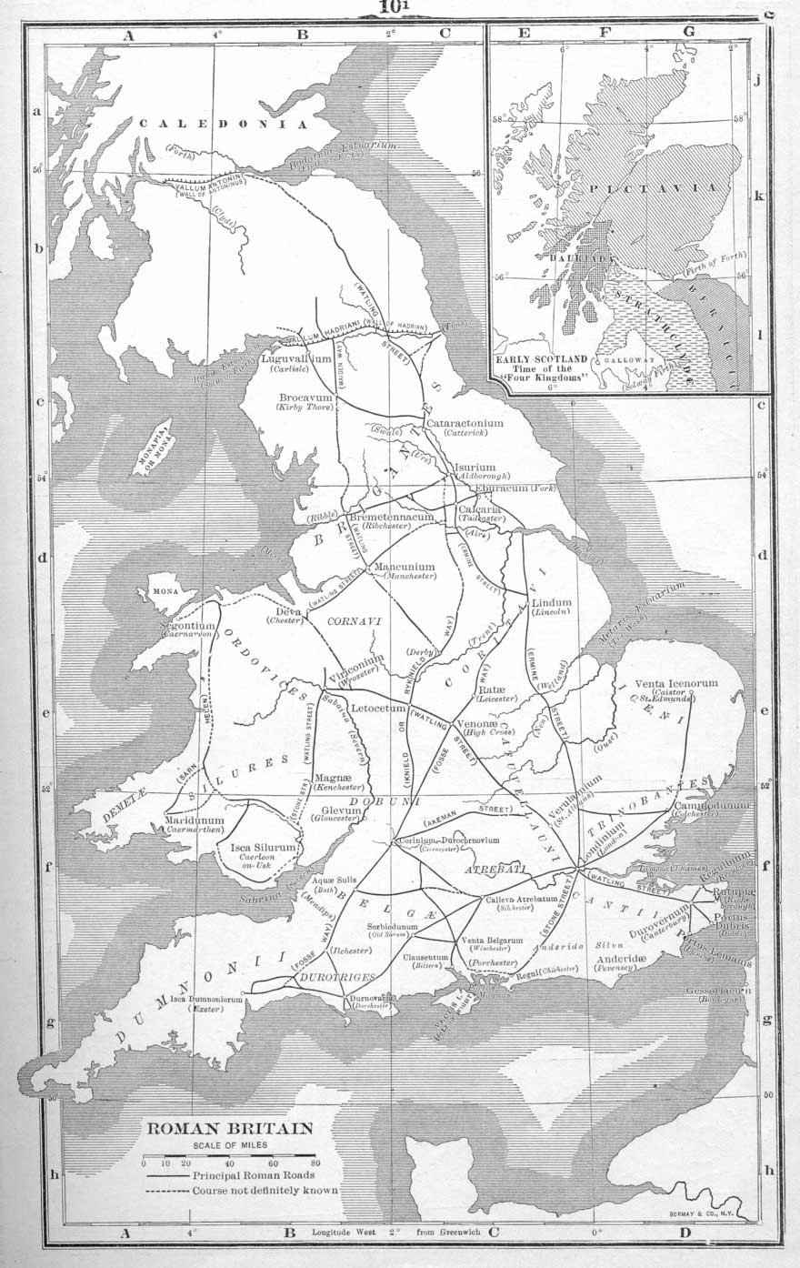
Carte des voies romaines en Bretagne romaine
Page d'aide sur l'homonymie Ne doit pas être confondu avec Ermin Street.

Ermine Street est une importante voie romaine longue de 322 km qui relie Londres (Londinium) à York (Eboracum), en Angleterre.

Son nom lui vient de Earninga Straete (1012), la voie des Earningas, une tribu qui habitait dans la région de Arrignton (Cambridgeshire) et Royston (Hertfordshire), à une quinzaine de kilomètres au sud-ouest de Cambridge. Elle est également connue sous le nom de Old North Road, la vieille route du nord. Ermine Street est encore utilisée sur une grande partie de son parcours.

Le tracé d'Ermine Street

Vieux pont d'Huntingdon.

La voie naît à Bishopsgate, l'une des portes de l'enceinte romaine de Londres. Passé cette porte, elle forme les rues de Shoreditch High Street puis Kingsland Road et Stoke Newington High Street et travers les districts londoniens de Stoke Newington, Enfield et Tottenham. Cette première section d'Ermine Street forme jusqu'à Royston l'actuelle route A10. À Royston, elle croise Icknield Way, l'une des plus anciennes routes de Grande-Bretagne, utilisée depuis le début de l'Âge du fer.

De Royston, elle rejoint Huntingdon et forme l'A1 à Alconbury jusqu'à l'ancien pont fortifié de Durobrivae (Water Newton), à l'est de Peterborough, où elle traversait la rivière Nene. La section d'Ermine Street entre Water Newton et Stamford est aujourd'hui un sentier public. Elle retrouve l'A1 jusqu'à Colsterworth puis est appelée High Dike (B6403). Après le carrefour avec l'A17, Ermine Street redevient un sentier qui s'arrête à Waddington, recouvert par une base aérienne de la Royal Air Force, à 5 km au sud de Lincoln. Elle est rejointe dans cette ville par l'importante voie de Fosse Way.

Après Lincoln, Ermine Street forme l'A15 jusqu'au village de Winteringham, sur l'Humber. La traversée de l'estuaire se faisait par bac jusqu'à Brough. La route s'incurve ensuite pour s'arrêter à York(A1034 et 1079).

Bibliographie

  • Thomas Codrington, Roman Roads in Britain, Londres, 1903
  • Ivan D. Margary, Roman Roads in Britain, Londres, 1967

Wikimedia Foundation. 2010.

Contenu soumis à la licence CC-BY-SA. Source : Article Ermine Street de Wikipédia en français (auteurs)

Игры ⚽ Нужен реферат?

Regardez d'autres dictionnaires:

  • Ermine Street — should not be confused with Ermin Street, the road from Silchester to Gloucester. Ermine Street Route of Ermine Street Route information Length: 193 mi (311 km) …   Wikipedia

  • Ermine Street — ist der Name einer Römerstraße in Britannien, die von Lindum (Lincoln) nach Eboracum (York) führte, in Römischer Zeit sogar von Noviomagus (Chichester) nach York. Der Bau begann im Jahr 43 n. Chr. Die Straße wurde im Mittelalter nach dem… …   Deutsch Wikipedia

  • Ermine Street — [Ermine Street] the name given to one of the main Roman roads in Britain, from London to ↑York …   Useful english dictionary

  • Ermine Street — the name given to one of the main Roman roads in Britain, from London to York. * * * ▪ ancient road, England, United Kingdom       major Roman road in England between London and York. It ran north from Bishopsgate, London, through Ware, Royston,… …   Universalium

  • Ermine Street — The ancient way which runs from London to Lincoln, leaving the city through the 11c Bishopsgate. Another of a similar name, spelt Irmine , runs from Silchester to Gloucester. [< OldEngl. Earninga street = road of the Earningas, i.e. Earn s… …   Dictionary of Medieval Terms and Phrases

  • Ermine Street — Roman road from London to Lincoln …   Medieval glossary

  • King Street (Roman road) — King Street is the name of a modern road on the line of a Roman road (getamap|TF106117|map. It runs on a straight course in eastern England, between the City of Peterborough and South Kesteven in Lincolnshire. This English name has long been… …   Wikipedia

  • Spital-in-the-Street — is a small hamlet in Lincolnshire, England. It is on the Roman Ermine Street ( hence the suffix ), which forms the modern A15 road, near its junction with the A631 road, known as Caenby Corner, 19 km ( 12 miles ) north of Lincoln. The first part… …   Wikipedia

  • Icknield Street — 52° 34′ 18″ N 1° 52′ 34″ W / 52.57166, 1.87602 …   Wikipédia en Français

  • Stoke Newington Church Street — is a road in north London in the borough of Hackney. The road links Green Lanes (A105) in the west to Stoke Newington High Street (A10) formerly Ermine Street, in the east. First noted in 1329, it was recorded as Newington or Newton Lane in 1403 …   Wikipedia

Share the article and excerpts

Direct link
Do a right-click on the link above
and select “Copy Link”