Ganzedijk
- Ganzedijk
-
53°12′27″N 7°7′14″E / 53.2075, 7.12056
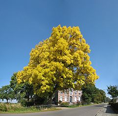
Ganzedijk est un village qui fait partie de la commune d'Oldambt dans la province néerlandaise de Groningue.
En 2008, la commune et la province présentèrent un projet de destruction du village de Ganzedijk. La population s'est soulevée contre cette décision et ont proposé un projet de maintien du village.
Wikimedia Foundation.
2010.
Contenu soumis à la licence CC-BY-SA. Source : Article Ganzedijk de Wikipédia en français (auteurs)
Regardez d'autres dictionnaires:
Richard Klinkhamer — (15 March, 1937) is a well known Dutch writer and Murderer.BiographyKlinkhamer is the son of Maria Vogelauer, an Austria woman who came to work in the Netherlands as a personal servant, and Gerrit Zeggelink, a worker for the Municipality of… … Wikipedia
Reiderland — Infobox Settlement official name = Reiderland mapsize = 280px subdivision type = Country subdivision name = Netherlands subdivision type1 = Province subdivision name1 = Groningen area footnotes = (2006) area total km2 = 156.72 area land km2 =… … Wikipedia
Kinderdijk — Coordinates: 51°53′N 4°38′E / 51.883°N 4.633°E / 51.883; 4.633 … Wikipedia
De Adriaan, Haarlem — Windmill De Adriaan De Adriaan is a windmill in the Netherlands that burnt down in 1932 and was rebuilt in 2002. The original windmill dates from 1779 and the mill has been a distinctive part of the skyline of Haarlem for centuries. Contents … Wikipedia
't Waar — 53°13′31″N 6°57′7″E / 53.22528, 6.95194 … Wikipédia en Français
Bad Nieuweschans — 53°12′22″N 7°10′51″E / 53.20611, 7.18083 … Wikipédia en Français
Beersterhoogen — 53° 10′ 59″ N 7° 08′ 06″ E / 53.1831, 7.135 … Wikipédia en Français
Beerta — 53°10′26″N 7°5′42″E / 53.17389, 7.095 … Wikipédia en Français
Booneschans — 53° 10′ 13″ N 7° 11′ 30″ E / 53.1703, 7.19167 … Wikipédia en Français
Drieborg — 53°12′22″N 7°10′51″E / 53.20611, 7.18083 … Wikipédia en Français
 Pays-Bas
 Ganzedijk (2008)
