Gunnedah
Contenu soumis à la licence CC-BY-SA. Source : Article Gunnedah de Wikipédia en français (auteurs)
Regardez d'autres dictionnaires:
Gunnedah — Original name in latin Gunnedah Name in other language GUH, Gunnedah, Gunnendah State code AU Continent/City Australia/Sydney longitude 30.98065 latitude 150.25838 altitude 273 Population 7148 Date 2012 02 28 … Cities with a population over 1000 database
Gunnedah — ▪ New South Wales, Australia town, east central New South Wales, Australia. It lies at the junction of the Conadilly and Namoi rivers, in the centre of the Liverpool Plains district. The site, discovered in 1818 by the explorer John Oxley,… … Universalium
Gunnedah — Admin ASC 2 Code Orig. name Gunnedah Country and Admin Code AU.02.13550 AU … World countries Adminstrative division ASC I-II
Gunnedah Motor Inn — (Gunnedah,Австралия) Категория отеля … Каталог отелей
Gunnedah, New South Wales — Infobox Australian Place | type = town name = Gunnedah state = nsw caption = Gunnedah viewed from Mt Porcupine. lga = Gunnedah Shire Council county = Pottinger postcode = 2380 est = 1833 pop = 7,542 (2006) elevation= 264 maxtemp = mintemp =… … Wikipedia
Gunnedah Shire — Shire of Gunnedah Lage des Gunnedah Shire in New South Wales Gliederung … Deutsch Wikipedia
Gunnedah Shire Council — Infobox Australian Place | type = lga name = Gunnedah Shire caption = Location in New South Wales state=New South Wales region=North West Slopes area=4994 est = seat=Gunnedah (63 Elgin Street} cite web title=Gunnedah Shire Council publisher =… … Wikipedia
Gunnedah Airport — Infobox Airport name = Gunnedah nativename = nativename a = nativename r = image width = caption = image2 width = caption2 = IATA = GUH ICAO = YGDH FAA = LID = type = Public owner = operator = owner oper = city served = location = Gunnedah, New… … Wikipedia
Gunnedah — /ˈgʌnəda/ (say gunuhdah) noun a town in north eastern NSW, on the Namoi River …
Electoral district of Gunnedah — Gunnedah was a former electoral district of the Legislative Assembly in the Australian state of New South Wales, created in 1880, partly replacing Liverpool Plains, and named after and including Gunnedah. In 1904 it was abolished and replaced by… … Wikipedia
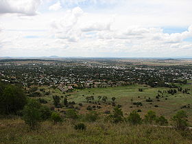 Gunnedah vu depuis
 Australie
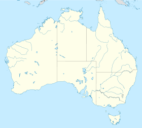
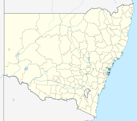
 Gunnedah