Haïvoron

Haïvoron
Haïvoron
Гайворон
Gaivoron arms.gif

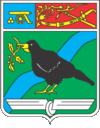
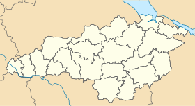
Géolocalisation sur la carte : Oblast de Kirovohrad

(Voir situation sur carte : Oblast de Kirovohrad)
Haïvoron

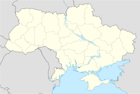
Géolocalisation sur la carte : Ukraine

(Voir situation sur carte : Ukraine)
Haïvoron
Coordonnées : 48°20′N 29°51′E / 48.333, 29.8548°20′N 29°51′E / 48.333, 29.85
Pays Drapeau d'Ukraine Ukraine
Subdivision Flag of Kirovohrad Oblast.svg Oblast de Kirovohrad
Maire Mykola Piabokoutchma
Fondation 1796
Statut Ville depuis 1949
Population en diminution 15 335 hab. (2011)
Indicatif tél. +380 5254
Code postal 26300
Liste des villes d'Ukraine | Carte

Haïvoron (en ukrainien : Гайворон) ou Gaïvoron (en russe : Гайворон) est une ville de l'oblast de Kirovohrad, en Ukraine, et le centre administratif du raïon de Haïvoron. Sa population s'élève à 15 335 habitants en 2011.

Sommaire

Géographie

Haïvoron est située au sud du Boug méridional, à 176 km à l'ouest de Kirovohrad.

Histoire

Haïvoron est fondée sur la rive sud du Boug au XVIIIe siècle comme un lieu d'hivernage des Cosaques. Elle a le statut de ville depuis 1949. C'est aujourd'hui un carrefour ferroviaire.

Population

Recensements (*) ou estimations de la population [1] :

Évolution démographique
1989* 2001* 2007 2008 2009 2010 2011
16 520 16 126 15 518 15 516 15 459 15 454 15 335

Notes et références

  1. (en) World Gazetteer [1](uk) Comité d'État de statistiques d'Ukraine : Статистичний збірник «Чисельність наявного населення України на 1 січня 2008 року» [Manuel statistique « Nombre d'habitants de l'Ukraine au 1er janvier 2008 »]. [2] ; «Статистичний збірник "Чисельність наявного населення України на 1 січня 2010 року» [Manuel statistique « Nombre d'habitants de l'Ukraine au 1er janvier 2010 »]. [3]

Liens externes


Wikimedia Foundation. 2010.

Contenu soumis à la licence CC-BY-SA. Source : Article Haïvoron de Wikipédia en français (auteurs)

Игры ⚽ Нужно сделать НИР?

Regardez d'autres dictionnaires:

  • Haivoron — ( uk. Гайворон) is a city in Kirovohrad Oblast (province) of Ukraine. Population is 16,126 (2001) …   Wikipedia

  • Narrow gauge railway — Track gauge by size Broad gauge St …   Wikipedia

  • Dobrovelychkivka — (Ukrainian: Добровеличківка) is a town located in the Kirovohrad Oblast (province) of southern Ukraine. It is the administrative center of the Dobrovelychkivskyi Raion (district). It hosts a regional bazaar on Wednesday and Friday morning, and is …   Wikipedia

  • Malovyskivskyi Raion — (Ukrainian: Маловисківський район) is a raion (district) of the Kirovohrad Oblast in central Ukraine. The city of Mala Vyska is the administrative center of the raion. The raion is mostly agricultural with some industries located around the… …   Wikipedia

  • Svitlovodsk — Світловодськ Seal …   Wikipedia

  • List of cities in Ukraine — As of January 1, 2010 there are 459 cities (Ukrainian: мiсто, misto) in Ukraine. Below is the list of all cities by population as of 2001 Ukrainian Census. Contents 1 Cities in Ukraine 2 City status 3 See also …   Wikipedia

  • Novomyrhorod — Location of Novomyrhorod and former New Serbia Enterin …   Wikipedia

  • List of raions in Ukraine by subdivision — Below is the list of all raions in Ukraine, listed by subdivisions of which they are a part. Contents 1 Autonomous Republic of Crimea 2 Cherkasy Oblast 3 Chernihiv Oblast 4 …   Wikipedia

  • Mala Vyska — (Ukrainian: Мала Виска) is a city in Kirovohrad Oblast (province) of Ukraine, and the administrative center of Malovyskivskyi Raion. Population is 13,132 (2001).  Administrative divisions of Kirovohrad Oblast, Ukraine …   Wikipedia

  • Novoukrainka — (Ukrainian: Новоукраїнка) is a city in Kirovohrad Oblast (province) of Ukraine. Population is 19,353 (2001).  Administrative divisions of Kirovohrad Oblast, Ukraine …   Wikipedia

Share the article and excerpts

Direct link
Do a right-click on the link above
and select “Copy Link”