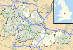
Highfield Road
Contenu soumis à la licence CC-BY-SA. Source : Article Highfield Road de Wikipédia en français (auteurs)
Regardez d'autres dictionnaires:
Highfield Road — Infobox Stadium stadium name = Highfield Road Stadium nickname = (Highfield Road) fullname = location = Hillfields, Coventry, England coordinates = broke ground = built = opened = 1899 renovated = expanded = closed = 30 April 2005 (last game)… … Wikipedia
Highfield Humanities College — Infobox UK school name = Highfield Humanities College size = latitude = 53.7880 longitude = 3.0290 dms = motto = motto pl = established = 1933 approx = closed = c approx = type = Community Comprehensive religion = president = head label =… … Wikipedia
Highfield House Condominium — Infobox Skyscraper building name= Highfield House | 4000 North Charles caption= preceded= year built= 1964 surpassed= year highest= year end= plural= location= status= groundbreaking= constructed= 1963 est completion= opening= destroyed= use=… … Wikipedia
Highfield, Harare — Highfield is a high density suburb in Harare, Zimbabwe. It is one of the oldest townships in Zimbabwe. Geography Highfield is a high density suburb to the south west of Harare the capital of Zimbabwe. Highfield was founded on what used to be… … Wikipedia
Highfield (stadium) — Highfield is a former home ground of The Wednesday Football Club and was located on London Road near to the centre of Sheffield. The club started to use the ground when they formed in 1867 and continued to use the ground until moving to Myrtle… … Wikipedia
Highfield (Île-du-Prince-Édouard) — Highfield Administration Pays Canada Province … Wikipédia en Français
Highfield RFC — Club fondé en 1930 Couleurs Maillot cerclé rouge, vert et noir short noir, bas rouge, noir et vert Surno … Wikipédia en Français
Highfield, North Ayrshire — Highfield is a very small village in North Ayrshire, Scotland about half a mile northeast of Dalry on the road to Beith … Wikipedia
Hihgfield Road — Highfield Road Highfield Road était un stade de football localisé à Coventry. Ce stade de 23 627 places fut inauguré le 9 septembre 1899. Le terrain fut équipé d un système d éclairage pour les matchs en nocturne en octobre 1953. Highfield Road é … Wikipédia en Français
Highfield, Hampshire — Infobox UK place country = England map type = Southampton official name= Highfield latitude = 50.9307 longitude = 1.4002 unitary england= Southampton lieutenancy england= Hampshire post town= SOUTHAMPTON postcode area= SO dial code= 023… … Wikipedia

 Angleterre