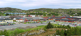
Hitra
Contenu soumis à la licence CC-BY-SA. Source : Article Hitra de Wikipédia en français (auteurs)
Regardez d'autres dictionnaires:
Hitra — Escudo … Wikipedia Español
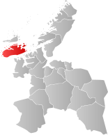
Hitra — Not to be confused with Hirta or Hidra Infobox Kommune name = Hitra idnumber = 1617 county = Sør Trøndelag landscape = capital = Fillan governor = Ole Haugen (AP) governor as of = 2007 arearank = 163 area = 685 arealand = 646 areapercent = 0.21… … Wikipedia
Hitra — Wappen Karte … Deutsch Wikipedia
Hitra — Sp Hitrà Ap Hitra L s. Norvegijos j., Norvegija … Pasaulio vietovardžiai. Internetinė duomenų bazė
Hitra — Admin ASC 2 Code Orig. name Hitra Country and Admin Code NO.16.1617 NO … World countries Adminstrative division ASC I-II
Hitra official football team — Infobox National football team Name = Hitra Badge = Hitra FA.gif FIFA Trigramme = no member of FIFA Elo Rank = Nickname = De Grå Elgene (The Gray Mooses) Association = Hitra Idrettsrâd Coach = Most caps = Top scorer = pattern la1=|pattern… … Wikipedia
Hitra Wind Farm — Infobox Power Station station name=Hitra Wind Farm location=Hitra, Norway owner=Statkraft status= fuel type=Wind mine type= conveyance= cooling water= technology= combined cycle= turbines=24 reciprocating engines= pumped storage= max capacity=55… … Wikipedia
Hitra Tunnel — The Hitra Tunnel is a subsea road tunnel connecting Hitra municipality (on Hitra Island) in the county of Sør Trøndelag, Norway to the mainland. The tunnel is 5,610 metres long and reaches a depth of 264 metres below sea level … Wikipedia
Hitra — Hịtra, Hịtteren, seen und moorreiche, teilweise bewaldete Insel Westnorwegens vor dem Eingang zum Trondheimfjord, 571 km2, bis 369 m über dem Meeresspiegel, 4 200 Einwohner (einschließlich kleiner umliegender Inseln) … Universal-Lexikon
Hitra disease — a disease of farmed Atlantic salmon among others caused by certain Vibrio species active at temperatures below 10°C and producing muscular and myocardial degeneration. Red or bloody streaks appear on the body and fins and can lead to fin and tail … Dictionary of ichthyology
 Norvège