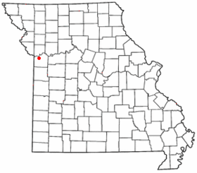
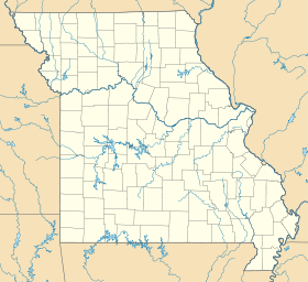
Independence (Missouri)
- Independence (Missouri)
-
39° 04′ 47″ N 94° 24′ 24″ W / 39.079722, -94.406667
Independence est une ville du Missouri faisant partie de l'agglomération de Kansas City, siège du comté de Jackson. Sa population est d'environ 115 000 habitants.
Géographie
Cette section est vide, insuffisamment détaillée ou incomplète.
Votre aide est la bienvenue !
Démographie
Au recensement de 2000, il y avait 113 288 habitants, 47 390 foyers et 30 566 familles. La densité de population était de 558,4 hab/km². Il y avait 50 213 unités de logement, soit 247,5 par km². La composition raciale était de 91,9% de Blancs et 2,6% de Noirs.
L'âge moyen de la population était de 38 ans.
6,4% des familles et 8,6% de la population était en dessous du seuil de pauvreté (dont 11,8% des mineurs et 6,7% des plus de 65 ans)
Jumelage
Résidents ou natifs célèbres
Wikimedia Foundation.
2010.
Contenu soumis à la licence CC-BY-SA. Source : Article Independence (Missouri) de Wikipédia en français (auteurs)
Regardez d'autres dictionnaires:
Independence, Missouri — Independence (Missouri) Pour les articles homonymes, voir Independence. Independence … Wikipédia en Français
Independence (Missouri) — Independence Lage in Missouri … Deutsch Wikipedia
Independence, Missouri — Infobox Settlement official name = Independence, Missouri settlement type = City nickname = motto = imagesize = image caption = image imagesize = image caption = image mapsize = 250px map caption = Location of Independence, Missouri mapsize1 =… … Wikipedia
St. Mary's High School (Independence, Missouri) — St. Mary s Bundschu Memorial High School is a private, Roman Catholic high school in Independence, Missouri. It is located in the Roman Catholic Diocese of Kansas City Saint Joseph.BackgroundSt. Mary s Bundschu Memorial High School was… … Wikipedia
Stone Church (Independence, Missouri) — Stone Church is a church in the United States. It is located in Independence, Missouri just south of the Temple Lot building and opposite the Community of Christ Temple.The Stone Church was constructed in the late 1800 s and is still in use today … Wikipedia
Missouri Mavericks — Gründung 2009 Geschichte Missouri Mavericks seit 2009 Stadion Independence Events Center … Deutsch Wikipedia
Missouri Comets — Founded 2010 Stadium Independence Events Center (Capacity: 5,800) Owners Top Of The Arc (TOTA), LLC (Mickey Scheetz, Edward L. Scheetz, Brian Budzinski) … Wikipedia
Independence Public School District — is a school district headquartered in Independence, Missouri, United States. The district serves most of Independence and Sugar Creek. Superintendent As of 2008 the Superintendent of Schools in the Independence Public School District is Dr. Jim… … Wikipedia
Independence (Misuri) — Independence Ciudad de los Estados Unidos … Wikipedia Español
Missouri Comets — Fundación 2010 Estadio Independence Events Center Capacidad 5,800 Entrenador … Wikipedia Español
 Pour les articles homonymes, voir Independence.
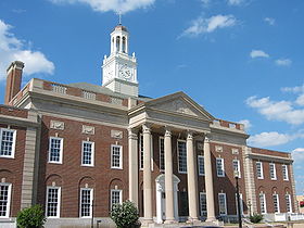
 États-Unis
 Missouri