Indian Island 28

Indian Island 28
Indian Island 28
Administration
Pays Drapeau du Canada Canada
Province Drapeau : Nouveau-Brunswick Nouveau-Brunswick
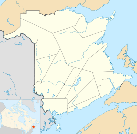
Comté ou équivalent Kent
Statut municipal Réserve indienne
Démographie
Population 97 hab. (2006)
Densité 360.3 hab./km2
Langue(s) Anglais
Géographie
Coordonnées
géographiques
46° 41′ 22″ N 64° 47′ 24″ W / 46.689486, -64.78998246° 41′ 22″ N 64° 47′ 24″ W / 46.689486, -64.789982
Altitude mini. 0 m — maxi. m
Superficie 0,27 km2
Fuseau horaire UTC-4
Indicatif +1-506

Géolocalisation sur la carte : Nouveau-Brunswick

(Voir situation sur carte : Nouveau-Brunswick)
Indian Island 28

Indian Island 28 est une réserve indienne canadienne située dans le Kent, à l'est du Nouveau-Brunswick.

Sommaire

Géographie

Indian Island est situé sur la pointe Sock, à 5 kilomètres à l'est de Richibouctou. Le village est au bord de la passe de l'île, un bras de la rivière Richibouctou la séparant de l'île Indian.

Géologie

Le sous-sol d'Indian Island est composé principalement de roches sédimentaires du groupe de Pictou datant du Pennsylvanien (entre 300 et 311 millions d'années)[1].

Administration

Indian Island 28 est la seule réserve de la Première nation micmaque Indian Island.

Conseil de bande

Mandat Fonctions Nom(s)
2010 - 2012 Chef Kenneth Barlow
Conseillers Geronimo Barlow, Ingrid Brooks.
Liste des chefs successifs de la première nation d'Indian Island
Parti Mandat Nom
     Indépendant 2010- Kenneth Barlow

Représentation et tendances politiques

Drapeau : Nouveau-Brunswick Nouveau-Brunswick: Indian Island 28 fait partie de la circonscription provinciale de Kent, qui est représentée à l'Assemblée législative du Nouveau-Brunswick par Shawn Graham, ancien Premier ministre du Nouveau-Brunswick. Il fut élu en 1999 puis réélu en 1999, en 2003, en 2006 et en 2010.

Drapeau du Canada Canada: Indian Island 28 fait partie de la circonscription fédérale de Beauséjour. Cette circonscription est représentée à la Chambre des communes du Canada par Dominic LeBlanc, du Parti libéral.

Vivre à Indian Island

L'église Blessed Keteri est une église catholique romaine faisant partie de l'archidiocèse de Moncton.

Municipalités limitrophes

Rose des vents Paroisse de Richibouctou
passe de l'île
Rose des vents
Cap-de-Richibouctou N ruisseau Gaspereau, Cap-de-Richibouctou
O    Indian Island 28    E
S
ruisseau Gaspereau
Cap-de-Richibouctou

Notes et références

Notes

Références

  1. (en) [PDF] Ministère des Ressources naturelles et de l'énergie du Nouveau-Brunswick, « Bedrock Geology of New Brunswick », 2000. Consulté le 19 juin 2009

Wikimedia Foundation. 2010.

Contenu soumis à la licence CC-BY-SA. Source : Article Indian Island 28 de Wikipédia en français (auteurs)

Игры ⚽ Поможем написать реферат

Regardez d'autres dictionnaires:

  • Indian Island — ist der Name mehrerer Inseln in den Vereinigten Staaten: Indian Island (Georgia) Indian Island (LaSalle County, Illinois) Indian Island (Rock Island County, Illinois) Indian Island (Whiteside County, Illinois) Indian Island (Humboldt County,… …   Deutsch Wikipedia

  • Indian Island — can refer to several places:Populated places* Indian Island, Washington * Penobscot Indian Island Reservation, near Old Town, Maine, known colloqially in Maine as Indian Island.Islands*Indian Island (Lake Erie) *Indian Island (Humboldt Bay)… …   Wikipedia

  • Indian Island, Washington — Indian Island is an unincorporated community in Jefferson County, Washington, United States. It is located between Port Townsend Bay and Kilisut Harbor. Parts also border on Oak Bay and Scow Bay. Until the construction of the Port Townsend Ship… …   Wikipedia

  • Indian Island (Washington) — Indian Island Área no incorporada de los Estados Unidos …   Wikipedia Español

  • Indian Island (Humboldt Bay) — Gunther Island Site 67 U.S. National Register of Historic Places U.S. National Historic Landmark …   Wikipedia

  • USS Indian Island (AG-77) — USS Indian Island (AG 77/AKS 25) was a Basilan class miscellaneous auxiliary acquired by the U.S. Navy shortly before the end of World War II. She was used to transport personnel and carry cargo and was inactivated and disposed of shortly after… …   Wikipedia

  • Penobscot Indian Island Reservation — is an Indian reservation for the Penobscot tribe in Penobscot County, Maine, United States near Old Town. The population was 562 at the 2000 census. A small, uninhabited part of the reservation is in Aroostook County. The reservation is home to a …   Wikipedia

  • Indian massacre — This is an incomplete list, which may never be able to satisfy particular standards for completeness. You can help by expanding it with reliably sourced entries. In the history of the European colonization of North America, the term Indian… …   Wikipedia

  • Indian cuisine — This article is part of the series …   Wikipedia

  • Island fox — Island fox[1] Conservation status …   Wikipedia

Share the article and excerpts

Direct link
Do a right-click on the link above
and select “Copy Link”