- Indian National Satellite System
-
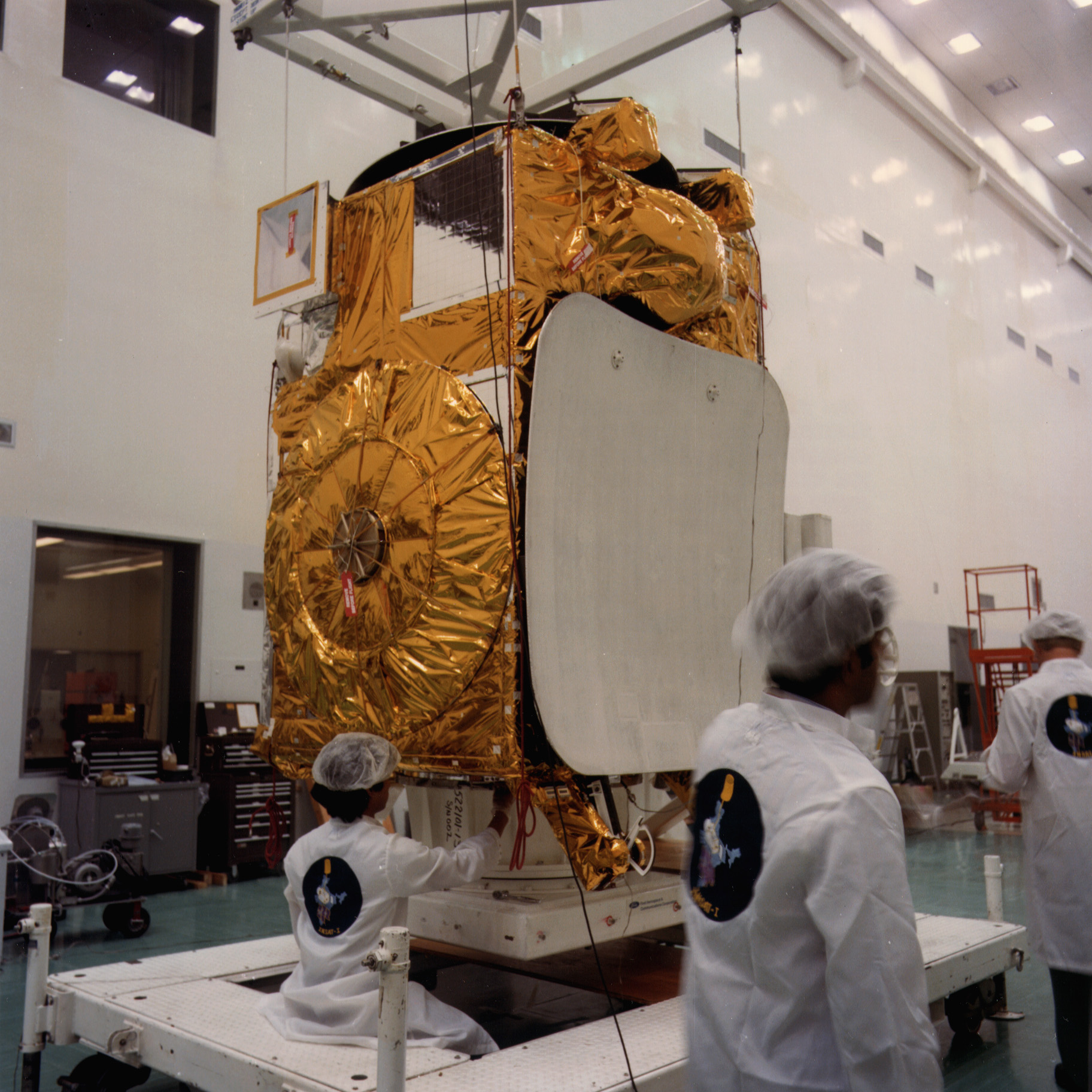
 INSAT-1B
L’Indian National Satellite System (INSAT) est une série de satellites sur orbite géostationnaire lancée par l’Indian Space Research Organisation pour les besoins de télécommunications, météorologiques et de recherche et sauvetage de l’Inde. Le premier satellite a été mis en orbite en 1983 et le réseau est maintenant le plus vaste de la région Asie-Pacifique.
INSAT est une collaboration entre le ministère de l’espace, celui des télécommunications, de All India Radio et Doordarshan, ainsi que du service météorologique indien. Le programme est géré par un comité de coordination entre les différents partenaires.
Les satellites d’INSAT compte au total 199 transpondeurs émettant ou recevant dans différentes bandes radio (C, S, C étendue et Ku) pour les besoins de la radio-télévision indienne. Quelques uns ont des radiomètres de haute précision (VHRR pour Very High Resolution Radiometer), des capteurs photographiques à haute résolution pour la météorologie et la métrologie. Finalement, les satellites incorporent des appareils de réception des signaux des radiobalises de localisation des sinistres dans le cadre du programme Cospas-Sarsat.
Sommaire
Liste des satellites INSAT
No Nom Date de lancement Statut[1] 1 INSAT-1A 10 avril 1982 Activé 6 septembre 1982 2 INSAT-1B 30 août 1983 Vie utile terminée 3 INSAT-1C 22 juillet 1988 Abandonné en novembre 1989 4 INSAT-1D 12 juin 1990 Vie utile terminée 5 INSAT-2A 10 juillet 1992 Premier satellite de télécommunication indien. Vie utile terminée. 6 INSAT-2B 23 juillet 1993 Vie utile terminée 7 INSAT-2C 7 décembre 1997 Vie utile terminée 8 INSAT-2D 4 juin 1997 Ne répond plus depuis 4 octobre 1997 9 INSAT-2DT En orbite d’attente Vie utile terminée 10 INSAT-2E 3 avril 1999 En service 11 INSAT-3A 10 avril 2003 En service 12 INSAT-3B 22 mai 2000 En service 13 INSAT-3C 24 janvier 2002 En service 14 KALPANA-1 12 septembre 2002 En service 15 GSAT-2 8 mai 2003 En service 16 INSAT-3E 28 septembre 2003 En service 17 EDUSAT 20 septembre 2004 En service 18 INSAT-4A 22 décembre 2005 En service 19 INSAT-4C 10 juillet 2006 Lancé mais n’a pas atteint son orbite dû à un problème avec la fusée GSLV-F02 20 INSAT-4B 12 mars 2007 En service 21 INSAT-4CR 2 septembre 2007 En service Voir aussi
- Geostationary Operational Environmental Satellite (GOES) américain
- Meteosat européen
- Geostationary Meteorological Satellite (GMS) japonais
Lien externe
Notes et références
- (en)Indian National Satellite System (INSAT), ISRO. Consulté le 8 août 2009.
Catégories :- Satellite météorologique
- Satellite de télécommunications
- Satellite de télédétection
- Satellite en orbite géostationnaire
- Programme spatial indien
Wikimedia Foundation. 2010.