- Interstate 43
-
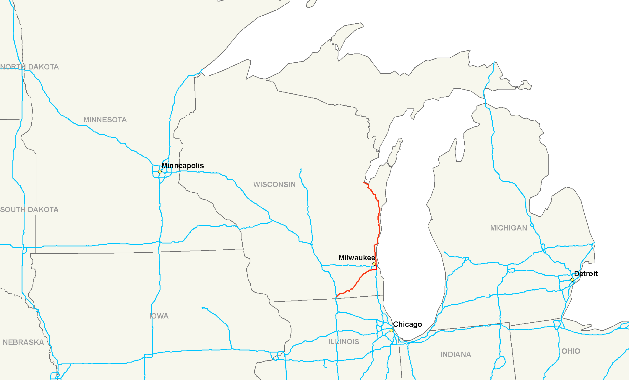
Interstate 43 

Longueur 308 km (191 mi) Direction sud / nord Extrémité sud 
 I-39/I-90 à Beloit, WI
Intersections  I-94 à Milwaukee, WI
Extrémité nord 
 US 41/US 141 près de Green Bay, WI
Réseau Interstate highway L'Interstate 43 (I-43) est une autoroute inter-États située à l'intérieur du Wisconsin. Son extrémité sud est à l'intersection de l'Interstate 39 et de l'Interstate 90, à Beloit. Son extrémité nord est à Green Bay, à une intersection avec la U.S. Route 41 et la U.S. Route 141.
Principales villes traversées
- Beloit, Wisconsin
- Milwaukee, Wisconsin
- Sheboygan, Wisconsin
- Manitowoc, Wisconsin
- Green Bay, Wisconsin
Divers
- La rivalité sportive qui existe entre les Panthers de l'Université du Wisconsin à Milwaukee et les Phoenix de l'Université du Wisconsin à Green Bay est appelée Bataille pour l'I-43 (en anglais : The Battle for I-43).
Voir aussi
Autoroutes inter-États (principales en rose) 
4 5 8 10 12 15 16 17 19 20 22 24 25 26 27 29 30 35 37 39 40 43 44 45 49 55 57 59 64 65 66 68 69 70 71 72 73 74 75 76 (W) 76 (E) 77 78 79 80 81 82 83 84 (W) 84 (E) 85 86 (W) 86 (E) 87 88 (W) 88 (E) 89 90 91 93 94 95 96 97 99 (238) H-1 H-2 H-3 Autres A-1 A-2 A-3 A-4 PRI-1 PRI-2 PRI-3 Catégories :- Autoroute inter-États américaine
- Route du Wisconsin

Wikimedia Foundation. 2010.