Itabashi
- Itabashi
-
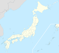
Itabashi (板橋区, Itabashi-ku?) est un des 23 arrondissements spéciaux (特別区, Tokubetsu-ku?) formant l'ancienne Ville de Tōkyō, au Japon. Le 1er octobre 1932 neuf bourgs et villages du district de Kitatoshima ont fusionné pour former un arrondissement de la ville de Tōkyō. Le 3 mai 1947, Itabashi est devenu un arrondissement spécial et le 1er août de la même année, Nerima s'est séparé de l'arrondissement pour former un arrondissement indépendant. La population de l'arrondissement est de 532 330 habitants (au 1er juin 2008) pour une superficie de 32,17 km².
Histoire
Le nom de cet arrondissement signifie "pont en planche" et dérive d'un pont en bois qui enjembait la rivière Shakujii pendant la période Heian. La construction d'un tel pont est remarquable pour l'époque.
Quartiers
Liens externes
Sur les autres projets Wikimedia :
Catégories :
- Municipalité de la préfecture de Tokyo
- Arrondissement de Tokyo
Wikimedia Foundation.
2010.
Contenu soumis à la licence CC-BY-SA. Source : Article Itabashi de Wikipédia en français (auteurs)
Regardez d'autres dictionnaires:
Itabashi — ku 板橋区 Geographische Lage in Japan … Deutsch Wikipedia
Itabashi-ku — Original name in latin Itabashi ku Name in other language Itabashi, Itabashi ku, ban qiao, ban qiao qu State code JP Continent/City Asia/Tokyo longitude 35.75118 latitude 139.70927 altitude 42 Population 531793 Date 2013 03 05 … Cities with a population over 1000 database
Itabashi-ku — Admin ASC 2 Code Orig. name Itabashi ku Country and Admin Code JP.40.1861322 JP … World countries Adminstrative division ASC I-II
Itabashi, Tokyo — Japanese city Name=Itabashi JapaneseName=板橋区 Prefecture=Tokyo Region=Kantō Area km2=32.17 Population=531,793 PopDate=2008 Density km2=16270 Coords= LatitudeDegrees= 35 LatitudeMinutes= 46 LatitudeSeconds= LongtitudeDegrees= 139 LongtitudeMinutes … Wikipedia
Itabashi (Tokio) — 板橋区 Itabashi Localización de Ita … Wikipedia Español
Itabashi execution grounds — The nihongo|Itabashi execution grounds|板橋刑場|Itabashi Keijō were one of the three sites in the vicinity of Edo (the forerunner of present day Tokyo, Japan) where the Tokugawa shogunate executed criminals in the Edo period. Located near Itabashi… … Wikipedia
Itabashi-shuku — Estampe de Itabashi shuku, de Keisai Eisen, première des 69 Stations du Nakasendō . Itabashi shuku (板橋宿, Itabashi shuku … Wikipédia en Français
Itabashi Botanical Garden — The Itabashi Botanical Garden (東京都板橋区立熱帯環境植物館, 1,000 m²) is an indoor botanical garden located at 8 29 2 Takashimadaira, Itabashi, Tokyo, Japan. It is open daily except Mondays; an admission fee is charged.The garden is a greenhouse containing… … Wikipedia
Itabashi-shuku — HistoryDuring the Edo period, Itabashi shuku flourshed as one of the four post stations in Edo and spread out over two kilometers from north to south. From the north of Tokyo, it was divided into three sections: Kami shuku (上宿), Naka shuku (中宿)… … Wikipedia
Itabashi-kuyakushomae Station — is a metro station on the Toei Mita Line in Itabashi, Tokyo, Japan. It is located under Itabashi Ward Office.Lines*Toei Mita Line (I 18) … Wikipedia

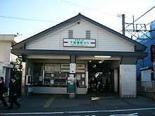 Gare de Shimo-Itabashi

