Itapetininga
- Itapetininga
-
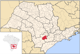
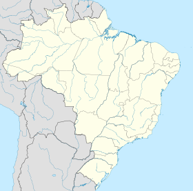
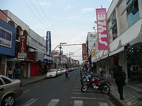
Itapetininga est une ville brésilienne appartenant à l'État de São Paulo. Sa population était estimée à 144 416 habitants en 2010. Elle devient politiquement autonome en 1770.
Maires
Liste des maires successifs
| Période |
Identité |
Étiquette |
Qualité |
| 2009 |
2012 |
Roberto Ramalho Tavares |
PMDB |
|
Source : [1]
Wikimedia Foundation.
2010.
Contenu soumis à la licence CC-BY-SA. Source : Article Itapetininga de Wikipédia en français (auteurs)
Regardez d'autres dictionnaires:
Itapetininga — Itapetininga … Wikipedia Español
Itapetininga — 23.591944444444 48.052777777778656 Koordinaten: 23° 36′ S, 48° 3′ W … Deutsch Wikipedia
Itapetininga — /ee teuh pe tee neeonn geuh/, n. a city in E Brazil. 56,437. * * * ▪ Brazil city, in the highlands of east central São Paulo estado (state), Brazil. It lies at 2,200 feet (670 m) above sea level, near the Itapetininga River. Formerly called … Universalium
Itapetininga — Infobox Settlement official name = Itapetininga other name = native name = nickname = settlement type = motto = imagesize = 275px image caption = Largo dos Amores square at night flag size = image seal size = image shield = shield size = city… … Wikipedia
Itapetininga — Original name in latin Itapetininga Name in other language Itapetinga, Itapetininga, ZTP State code BR Continent/City America/Sao Paulo longitude 23.59167 latitude 48.05306 altitude 670 Population 126243 Date 2012 08 03 … Cities with a population over 1000 database
Itapetininga — Admin ASC 2 Code Orig. name Itapetininga Country and Admin Code BR.27.3522307 BR … World countries Adminstrative division ASC I-II
Itapetininga — /ee teuh pe tee neeonn geuh/, n. a city in E Brazil. 56,437 … Useful english dictionary
Microrégion d'Itapetininga — Microrregião de Itapetininga Informations Pays … Wikipédia en Français
Mésorégion d'Itapetininga — Mesorregião de Itapetininga Informations Pays … Wikipédia en Français
Mesoregion d'Itapetininga — Mésorégion d Itapetininga Étendue de la région d Itapetininga. La région d Itapetininga est l une des quinze mésorégions de l État de São Paulo. Elle regroupe 36 municipalités groupées en quatre microrégions. Données La région compte 8 … Wikipédia en Français

 Brésil
 São Paulo