Allaire Airport
- Allaire Airport
-
Belmar
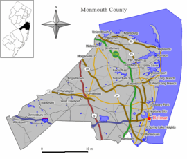
Belmar est un borough situé dans le comté de Monmouth dans le New Jersey aux États-Unis. Selon le recensement de 2000, sa population s’élève à 6 045 habitants (estimée à 5 962 en 2005). Densité : 1 512,6 hab/km² (3 914,5 hab/mi²). Superficie totale : 4,4 km² (1,7 mi²). Coordonnées géographiques : 40°10′42″N 74°1′21″O / 40.17833, -74.0225 (40.178342, -74.022446).
Le borough a été incorporé en 1885, son nom date de 1890. De nos jours, la plage de Belmar est un des lieux les plus prisés des surfeurs sur la côte est.
Belmar possède un aéroport (Monmouth Executive Airport auparavant appelé Allaire Airport, code AITA : BLM), situé près de Farmingdale.
Source
- (en) Cet article est partiellement ou en totalité issu d’une traduction de l’article de Wikipédia en anglais intitulé « Belmar, New Jersey ».
 Portail des États-Unis
Catégories : Ville du New Jersey | Comté de Monmouth
Wikimedia Foundation.
2010.
Contenu soumis à la licence CC-BY-SA. Source : Article Allaire Airport de Wikipédia en français (auteurs)
Regardez d'autres dictionnaires:
Allaire — est un patronyme d origine française (bretonne), présent en France et au Québec. Sommaire 1 Sens et origine du nom 2 Quelques variantes 3 Personnalités … Wikipédia en Français
Monmouth Executive Airport — IATA: BLM – ICAO: KBLM – FAA LID: BLM Summary Airport type Public Owner Wall Herald Corp … Wikipedia
Monmouth Executive Airport — Belmar Belmar Pays États Unis État … Wikipédia en Français
Central Jersey — is an unofficial designation for the central region of the State of New Jersey in the United States of America. The two main portions of the region are separated by the Raritan River. The so called Raritan Valley makes up the northern portion of… … Wikipedia
Liste der IATA-Codes/B — Diese Teilliste führt alle IATA Flughafen Codes auf, die mit „B“ beginnen, und enthält Informationen zu den bezeichneten Verkehrsknotenpunkten. IATA Codes A B C D E F G H I … Deutsch Wikipedia
Belmar — 40°10′42″N 74°1′21″O / 40.17833, 74.0225 … Wikipédia en Français
Wall Township, New Jersey — Infobox Settlement official name = Wall Township, New Jersey settlement type = Township nickname = motto = imagesize = image caption = image mapsize = 250x200px map caption = Map of Wall Township in Monmouth County. Inset: Location of Monmouth… … Wikipedia
Sark — For other uses, see Sark (disambiguation). Sark Sèr Sercq Cerq … Wikipedia
Cheboygan County, Michigan — Seal … Wikipedia
New Jersey Route 34 — Route 34 Route information … Wikipedia
 États-Unis
 New Jersey