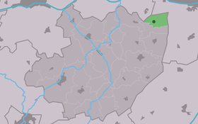
Jellum
Contenu soumis à la licence CC-BY-SA. Source : Article Jellum de Wikipédia en français (auteurs)
Regardez d'autres dictionnaires:
Lääz Rockit — Laaz Rockit Gründung 1982 Genre Thrash Metal, Heavy Metal Website http://www.laazrockit.com/ Gründungsmitglieder Gesang Michael Coons … Deutsch Wikipedia
Flaming Geyser State Park — is a State Park of Washington, USA, named after a pair of geysers. The first is a natural gas vent that burns with a low methane flame, while the second is a bubbling geyser in a natural spring. This Park lies at the downstream end of the Green… … Wikipedia
Fumarylacetoacetate hydrolase — (fumarylacetoacetase), also known as FAH, is a human gene.cite web | title = Entrez Gene: FAH fumarylacetoacetate hydrolase (fumarylacetoacetase)| url = http://www.ncbi.nlm.nih.gov/sites/entrez?Db=gene Cmd=ShowDetailView TermToSearch=2184|… … Wikipedia
City's Gonna Burn — Studio album by Lääz Rockit Released … Wikipedia
Nothing'$ $acred — Studio album by Lääz Rockit Released 1991 … Wikipedia
Laaz Rockit — Allgemeine Informationen Genre(s) Thrash Metal, Heavy Metal Gründung 1982 Website … Deutsch Wikipedia
No Stranger to Danger (Lääz Rockit album) — No Stranger to Danger Studio album by Lääz Rockit Released … Wikipedia
Littenseradiel — Infobox Settlement official name = Littenseradiel image seal size = 70px mapsize = 280px subdivision type = Country subdivision name = Netherlands subdivision type1 = Province subdivision name1 = Friesland area footnotes = (2006) area total km2 … Wikipedia
Cover crop — Agriculture General … Wikipedia
List of places in the Netherlands — This is an alphabetical list of places (cities, towns, villages) in the Netherlands. Lists per province can be found at:* List of towns in Groningen * List of towns in Friesland * List of towns in Drente * List of towns in Overijssel * List of… … Wikipedia
 Pays-Bas