Jolfa

Jolfa

38° 56′ N 45° 40′ E / 38.93, 45.67

Jolfa
(fa) جلفا
Defaut.svg
Administration
Pays Drapeau d'Iran Iran
Province Azerbaïdjan oriental
Indicatif téléphonique international +(98)
Géographie
Coordonnées 38° 56′ Nord
       45° 40′ Est
/ 38.93, 45.67
Altitude 804 m
Démographie
Population 56 000 hab. (2006)
Localisation
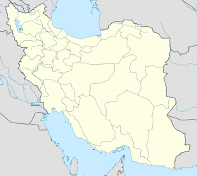
Iran location map.svg
City locator 14.svg
Jolfa
Sources
World Gazetteer
Index Mundi

Jolfa (en persan : جلفا) est une petite ville d’Iran de la province d’Azerbaïdjan oriental. Elle est située sur la frontière de la République d’Azerbaïdjan, plus précisément de la province autonome du Nakhitchevan. Elle a une population d’environ 56 000 habitants.

Jolfa est une des villes frontières les plus importantes de la République islamique d'Iran. Les installations douanières dans la ville et le chemin de fer Caucase-Jolfa ont été conçues pour satisfaire les opérations en douane, le stockage, le transfert de chargement de trois millions de tonnes de biens par an. Avant la chute de l’Union soviétique, toutes les importations et les exportations avec l’Union soviétique, l’Europe de l'Est et la Scandinavie passaient par Jolfa.


Wikimedia Foundation. 2010.

Contenu soumis à la licence CC-BY-SA. Source : Article Jolfa de Wikipédia en français (auteurs)

Игры ⚽ Нужно сделать НИР?

Regardez d'autres dictionnaires:

  • jolfă — jólfă, jólfe, s.f. (reg.) v. júlfă. Trimis de blaurb, 13.09.2007. Sursa: DAR …   Dicționar Român

  • Jolfa — Infobox Settlement official name = PAGENAME native name = imagesize = image caption = image map caption = pushpin pushpin label position =bottom pushpin mapsize = 300 pushpin map caption =Location in Iran subdivision type = Country subdivision… …   Wikipedia

  • Jolfa — جلفا Jolfa …   Wikipedia Español

  • Jolfa County — ( fa. شهرستان جلفا) is a county in East Azarbaijan Province in Iran. The capital of the county is Jolfa.References* اطلس گیتاشناسی استان‌های ایران [Atlas Gitashenasi Ostanhai Iran] ( [http://www.gitashenasi.com/En/Product/Index.cfm?I=9… …   Wikipedia

  • Saint-Stepanos de Jolfa — Ensembles monastiques arméniens d Iran * Patrim …   Wikipédia en Français

  • Shahrestan-e Jolfa — Admin ASC 2 Code Orig. name Shahrestān e Jolfā Country and Admin Code IR.33.449431 IR …   World countries Adminstrative division ASC I-II

  • Iran — /i ran , i rahn , uy ran /, n. a republic in SW Asia. 67,540,002; ab. 635,000 sq. mi. (1,644,650 sq. km). Cap.: Teheran. Formerly (until 1935), Persia. * * * Iran Introduction Iran Background: Known as Persia until 1935, Iran became an Islamic… …   Universalium

  • East Azerbaijan Province — This article is about the Iranian province. For other uses, see Azerbaijan (disambiguation). East Azerbaijan Province استان آذربایجان شرقی    …   Wikipedia

  • Islamic Republic of Iran Railways — Infobox SG rail railroad name = Islamic Republic of Iran Railways logo filename = IRIR.logo.gif logo size = 100 system map size = 300px locale = Iran hq city = TehranThe Islamic Republic of Iran Railways (RAI) is the national state owned railway… …   Wikipedia

  • Aras Free Zone — Aras Free Trade Industrial Zone is situated in East Azarbaijan province, in the north west of Iran, adjacent to Autonomous Republic Nakhichivan, Armenia and the Republic of Azerbaijan. The climate is mild thanks to the Aras River and Arasbaran… …   Wikipedia

Share the article and excerpts

Direct link
Do a right-click on the link above
and select “Copy Link”