Kajtasovo

Kajtasovo
Kajtasovo
Кајтасово
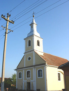
L'église orthodoxe serbe de Kajtasovo
Administration
Pays Drapeau de Serbie Serbie
Province Voïvodine
Région Banat serbe
District Banat méridional
Municipalité Bela Crkva
Code postal 26 329
Géographie
Coordonnées 44° 52′ 35″ Nord
       21° 15′ 18″ Est
/ 44.8764, 21.2550
Altitude 66 m
Superficie 4 290 ha = 42,9 km2
Démographie
Population 287 hab. (2002)
Densité 6,7 hab./km2
Localisation
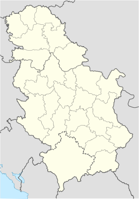
Serbia location map.svg
City locator 14.svg
Kajtasovo

Kajtasovo (en serbe cyrillique : Кајтасово ; en hongrois : Gajtas) est un village de Serbie situé dans la province autonome de Voïvodine. Il fait partie de la municipalité de Bela Crkva dans le district du Banat méridional. En 2002, il comptait 287 habitants[1], dont une majorité de Serbes.

Sommaire

Démographie

Évolution historique de la population

Évolution démographique
1948 1953 1961 1971 1981 1991 2002
503 490 494 459 424 350 287[1]

Répartition de la population (2002)

Nationalité Nombre %
Serbes 253 88,15
Hongrois 10 3,38
Roumains 7 2,43
Macédoniens 6 2,09
Russes 2 0,69
Allemands 1 0,34
Yougoslaves 1 0,34
Inconnus/Autres[2]

Notes et références

  1. a et b (sr) Livre 9, Population, analyse comparative de la population en 1948, 1953, 1961, 1971, 1981, 1991 et 2002, données par localités, Institut de statistique de la République de Serbie, Belgrade, mai 2004 (ISBN 86-84433-14-9)
  2. (sr) Livre 1, Population, origine nationale ou ethnique, données par localités, Institut de statistique de la République de Serbie, Belgrade, février 2003 (ISBN 86-84433-00-9)

Voir aussi

Sur les autres projets Wikimedia :

Articles connexes

Liens externes


Wikimedia Foundation. 2010.

Contenu soumis à la licence CC-BY-SA. Source : Article Kajtasovo de Wikipédia en français (auteurs)

Игры ⚽ Нужен реферат?

Regardez d'autres dictionnaires:

  • Kajtasovo — (Кајтасово) is a village in Serbia. It is situated in the Bela Crkva municipality, in the South Banat District, Vojvodina province. The village has a Serb ethnic majority and its population numbering 287 people (2002 census).Historical… …   Wikipedia

  • Bela Crkva (Vojvodina) — Bela Crkva Бела Црква   Municipality and Town   The St. Ana Catholic Church …   Wikipedia

  • Karaš River — Geobox River name = Karaš (Караш) Caraş native name = other name = other name1 = image size = 300 px image caption = The Karaš River near Dobričevo, Serbia country type = Countries state type = region type = district type = Counties city type =… …   Wikipedia

  • Bela Crkva (Voivodine) — Bela Crkva (Voïvodine) Pour les articles homonymes, voir Bela Crkva. Bela Crkva Бела Црква …   Wikipédia en Français

  • Bela Crkva (Voïvodine) — Pour les articles homonymes, voir Bela Crkva. Bela Crkva Бела Црква …   Wikipédia en Français

  • Pančevo — Панчево   City   Church of the Assumption …   Wikipedia

  • Vršac — For the Bulgarian city, see Varshets. Vršac Вршац   Municipality and Town   Panoramic view of Vr …   Wikipedia

  • South Banat District — Južnobanatski okrug Јужнобанатски округ   District of Serbia   Location of South Banat District in Serbia …   Wikipedia

  • Kovačica — Ковачица Kovačica   Municipality and Town   …   Wikipedia

  • Alibunar — Алибунар   Municipality and Town   Serbian Orthodox church in Alibunar …   Wikipedia

Share the article and excerpts

Direct link
Do a right-click on the link above
and select “Copy Link”