Kloosterzande
Contenu soumis à la licence CC-BY-SA. Source : Article Kloosterzande de Wikipédia en français (auteurs)
Regardez d'autres dictionnaires:
Kloosterzande — Kloosterzande … Wikipedia Español
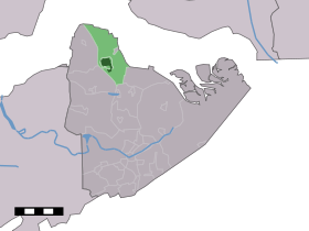
Kloosterzande — Dutch town locator maps mun town caption = The town centre (dark green) and the statistical district (light green) of Kloosterzande in the municipality of Hulst.Kloosterzande (coord|51|22|N|4|1|E|type:city(2743)) is a town in the Dutch province… … Wikipedia
Kloosterzande — Sp Klòsterzandė Ap Kloosterzande L Nyderlandai … Pasaulio vietovardžiai. Internetinė duomenų bazė
Kloosterzande — Sp Klòsterzandė Ap Kloosterzande L Olandija … Pasaulio vietovardžiai. Internetinė duomenų bazė
Hof te Zande Kerk (Kloosterzande) — Die Hof te Zande Kerk Die Hof te Zande Kerk ist eine im Kern frühgotische evangelisch unierte Pfarrkirche zu Hulst Kloosterzande (Provinz Zeeland) in den Niederlanden. Sie war ursprünglich eine Kapelle der Zisterzienser und ist der besterhaltene… … Deutsch Wikipedia
Boerenhuisje — (Kloosterzande,Нидерланды) Категория отеля: Адрес: Noordstraat 12, 4588 KM Kloosterzan … Каталог отелей
Kruisdorp (Zelande) — Kruisdorp (Zélande) Kruisdorp Pays Pays Bas Commune Hulst Province Zélande Nombre d habitants ? (?) Code pos … Wikipédia en Français
Kruisdorp (Zélande) — 51° 21′ 57″ N 4° 02′ 21″ E / 51.3658, 4.03917 … Wikipédia en Français
Zeeuwsch-Vlaamsche Tramweg-Maatschappij — Die Zeeuwsch Vlaamsche Tramweg Maatschappij (ZVTM) war ein öffentliches Verkehrsmittel in der Mitte und dem Osten von Zeeuws Vlaanderen (Seeländisch Flandern). Sein Betrieb erfolgte von 1911 bis 1949 mit Dampf. Unmittelbar nach seiner Gründung im … Deutsch Wikipedia
Gerrie Knetemann — Infobox Cyclist ridername = Gerrie Knetemann fullname = Gerrie Knetemann nickname = de Kneet dateofbirth = birth date|1951|03|06 dateofdeath = death date and age|2004|11|02|1951|03|06 country = NED height = weight = currentteam = discipline =… … Wikipedia
 Pays-Bas