Kolare

Kolare
Kolare
Коларе
Administration
Pays Drapeau de Serbie Serbie
Province Serbie centrale
Région Šumadija
Belica
District Pomoravlje
Ville Jagodina
Code postal 35 242
Géographie
Coordonnées 43° 54′ 01″ Nord
       21° 14′ 14″ Est
/ 43.9003, 21.2372
Altitude 224 m
Démographie
Population 619 hab. (2002)
Localisation
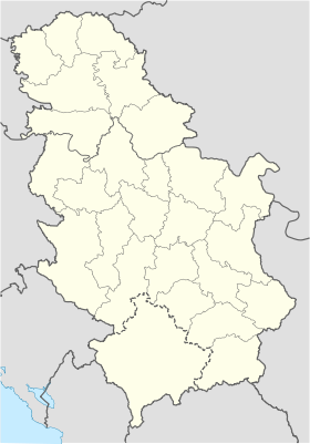
Serbia location map.svg
City locator 14.svg
Kolare

Kolare (en serbe cyrillique : Коларе) est un village de Serbie situé sur le territoire de la Ville de Jagodina, district de Pomoravlje. En 2002, il comptait 619 habitantss[1], dont une majorité de Serbes.

Kolare est situé sur les bords du Lugomir, un affluent de la Velika Morava.

Sommaire

Démographie

Évolution historique de la population

Évolution démographique
1948 1953 1961 1971 1981 1991 2002
391 679 705 685 657 629 619[1]

Répartition de la population (2002)

Nationalité Nombre %
Serbes 615 99,35
Yougoslaves 2 0,32
Monténégrins 1 0,16
Inconnus/Autres[2]

Notes et références

  1. a et b (sr) Livre 9, Population, analyse comparative de la population en 1948, 1953, 1961, 1971, 1981, 1991 et 2002, données par localités, Institut de statistique de la République de Serbie, Belgrade, mai 2004 (ISBN 86-84433-14-9)
  2. (sr) Livre 1, Population, origine nationale ou ethnique, données par localités, Institut de statistique de la République de Serbie, Belgrade, février 2003 (ISBN 86-84433-00-9)

Voir aussi

Articles connexes

Liens externes


Wikimedia Foundation. 2010.

Contenu soumis à la licence CC-BY-SA. Source : Article Kolare de Wikipédia en français (auteurs)

Игры ⚽ Нужна курсовая?

Regardez d'autres dictionnaires:

  • Koláre — (Village) Administration Pays  Slovaquie …   Wikipédia en Français

  • Koláre — ( hu. Kóvár) is a village and municipality in the Veľký Krtíš District of the Banská Bystrica Region of southern Slovakia.External links*http://www.statistics.sk/mosmis/eng/run.html …   Wikipedia

  • kolare — s ( n, kolare, best. pl. kolarna) …   Clue 9 Svensk Ordbok

  • Jagodina — Јагодина Héraldique …   Wikipédia en Français

  • Jagodina — Infobox Serbia municipality native name = Јагодина|official name=Jagodina common name = Jagodina image shield = Jagodina.png district = Pomoravlje mayor = Dragan Marković (US) area km2 = 470 population total = 35589 | mpop=70894 latd = 43| latm …   Wikipedia

  • Banská Bystrica Region — Geobox | Region name = Banská Bystrica other name = category = Region image caption = image caption = symbol = symbol type = Coat of arms etymology = official name = motto = nickname = country = Slovakia country state = region = district =… …   Wikipedia

  • Veľký Krtíš District —   District   Country Slovakia Region ( …   Wikipedia

  • Lugomir — Infobox River | river name = Lugomir (Лугомир) caption = origin = Gledićke planine mountains, central Serbia (as Dulenska reka ) mouth = Velika Morava, east of Jagodina, Serbia basin countries = Serbia length = 57 km elevation = 793 m discharge …   Wikipedia

  • Veľký Krtíš — Coordinates: 48°12′54″N 19°20′17″E / 48.215°N 19.33806°E / 48.215; 19.33806 …   Wikipedia

  • Dolinka — See also: Dolinka, Człuchów County Veľký Krtíš District in the Banská Bystrica region Dolinka (Hungarian: Inám) is a village and municipality in the Veľký Krtíš District of the Banská Bystrica Region of southern Slovakia …   Wikipedia

Share the article and excerpts

Direct link
Do a right-click on the link above
and select “Copy Link”