Koondrook
- Koondrook
-
Koondrook (802 habitants) est une ville du nord de l'État de Victoria à 301 km au nord-ouest de Melbourne sur le fleuve Murray.
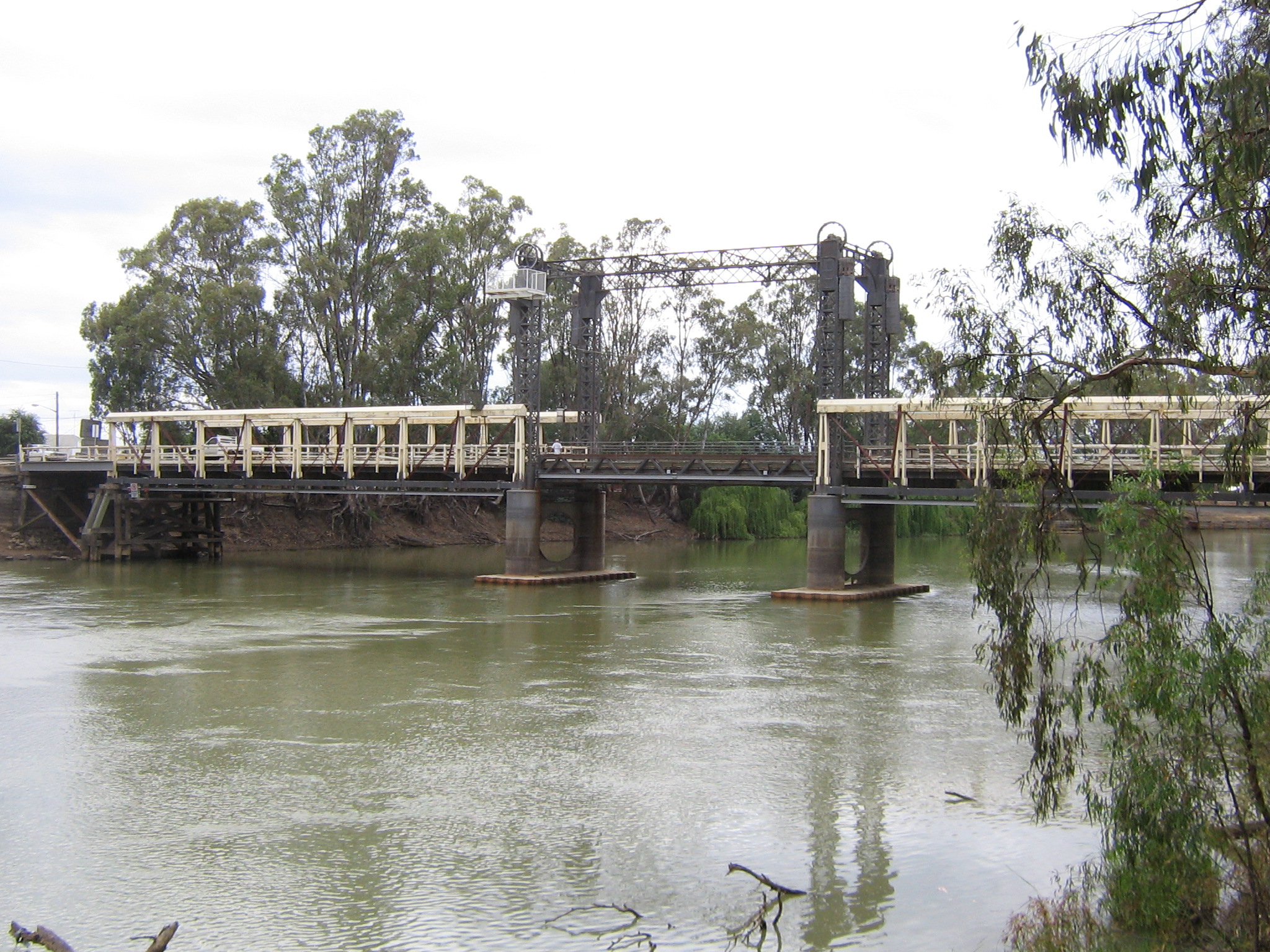
Koondrook est relié par un pont à sa ville jumelle de Barham dans l'État voisin de Nouvelle-Galles du Sud. L'économie du village comprend la production laitière sur les rives du fleuve et la production d'agrumes dans les zones irriguées par le Murray. Le bois des gommiers des forêts environnantes est utilisé dans la production de bois de charpentes et de meubles.
La pêche et le camping sont des activités très populaires pour les touristes dans les forêts. Les forêts sont d'importantes zones de reproduction pour les oiseaux sédentaires et des aires de repos pour les oiseaux migrateurs.
Les aborigènes Wemba-Wemba semblent avoir habité la région de Koondrook avant la colonisation par les Européens commencée en 1843. En 1889, une ligne de chemin de fer reliant Koondrook à Kerang et au réseau ferroviaire de Victoria fut ouverte. Elle a été officiellement fermée le 3 mars 1981.
Références
Wikimedia Foundation.
2010.
Contenu soumis à la licence CC-BY-SA. Source : Article Koondrook de Wikipédia en français (auteurs)
Regardez d'autres dictionnaires:
Koondrook, Victoria — Infobox Australian Place | type = town name = Koondrook state = vic caption = Main street of Koondrook lga = Shire of Gannawarra postcode = 3580 est = pop = 802 pop footnotes = elevation= 78 maxtemp = 22.2 mintemp = 8.4 rainfall = 391.4 stategov … Wikipedia
Koondrook — /ˈkundrʊk/ (say koohndrook) noun a town in Northern Victoria, adjoining Barham on the Murray River …
Kerang-Koondrook Tramway — The Kerang Koondrook Tramway was an Australian private railway of RailGauge|63 broad gauge, running from the state owned Victorian Railways network at Kerang to the Murray River town of Koondrook.The convert|13.94|mi|km long line was opened in… … Wikipedia
Murray Valley Highway — Murray Valley Highway … Wikipedia
Barham, New South Wales — Infobox Australian Place | type = town name = Barham state = nsw caption = The main street of Barham, with the Barham Hotel in the foreground lga = Council of the Shire of Wakool postcode = 2732 pop = 1,132 (2006 census) est = elevation= 73… … Wikipedia
Kerang, Victoria — Infobox Australian Place | type = town name = Kerang state = vic caption = Victoria Street in central Kerang lga = Shire of Gannawarra postcode = 3579 est = pop = 3780 (2006)Census 2006 AUS | id = SSC25859 | name = Kerang (State Suburb) |… … Wikipedia
Alexander Arbuthnot (paddle steamer) — The Alexander Arbuthnot is the last paddle steamer built as a working boat on the Murray River, Australia. Not to be confused with the steam ship Arbuthnot, a vessel of 41 tons which was burnt at Murrumbidgee junction, Murray River, 1913… … Wikipedia
Gannawarra Shire — Lage des Gannawarra Shire in Victoria Gliederung … Deutsch Wikipedia
Shire of Gannawarra — Gannawarra Shire Lage des Gannawarra Shire in Victoria Basisdaten Bundesstaat: Victoria Hauptort: Kerang Fläche: 3.741 … Deutsch Wikipedia
Comté de Gannawarra — 35°43′00″S 143°55′00″E / 35.716667, 143.916667 … Wikipédia en Français
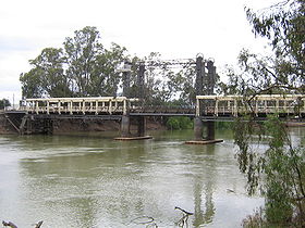 Le pont sur le Murray reliant Koondrook à Barham.
 Australie