Kotlenik
- Kotlenik
-
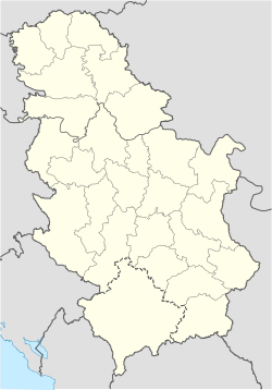
Le mont Kotlenikc (en serbe cyrillique : Котленик) est une montagne de Serbie. Elle culmine au pic du Veliki vrh, qui s'élève à une altitude de 749 m[1].
Géographie
Le mont Kotlenik est situé entre les plaines de la Zapadna Morava et de la Gruža. Ses pics les plus élevés sont la Čemernica (487 m), la Borča (508 m), la Kraljica (578 m), la Šiljata kosa (590), le Klupe (549 m), le Crni vrh et la Velika Livada (748 m), la Gradinčica (700 m), les Orlovi (667 m) et le Veliki vrh (748 m)[1].
Notes et références
Voir aussi
Articles connexes
Wikimedia Foundation.
2010.
Contenu soumis à la licence CC-BY-SA. Source : Article Kotlenik de Wikipédia en français (auteurs)
Regardez d'autres dictionnaires:
Kotlenik — Kotlenik, Waldgebirge im Kreise Jagedina des Fürstenthums Serbien … Pierer's Universal-Lexikon
Pomoravlje (region) — Pomoravlje (Serbian Cyrillic: Поморавље), is a general term which in its widest sense marks valleys of any of three Morava rivers in Serbia: West Morava (Zapadno or Western Pomoravlje), Južna Morava (Južno or Southern Pomoravlje) and Great Morava … Wikipedia
Kraljevo — Infobox Settlement bgcolor= #BBDDFF name = Kraljevo official name = City of Kraljevo other name = Kraljevo native name = Краљево nickname = motto = Nama dobro, a nikome zlo. imagesize = 240px image caption = Monument to the serbian soldiers… … Wikipedia
West Morava — Infobox River | river name = West Morava (Западна Морава) caption = Drainage basin of West Morava origin = Golija mountain, northeast of Sjenica, Serbia mouth = with the Južna Morava forms the Great Morava at Stalać, Serbia basin countries =… … Wikipedia
Danube Banovina — Dunavska banovina Дунавска бановина banovina of the Kingdom of Yugoslavia … Wikipedia
Gruža River — Infobox River river name = Gruža (Гружа) caption = origin = Rudnik mountain, central Serbia mouth = village of Čukojevac, Zapadna Morava, central Serbia basin countries = Serbia length = 77 km elevation = discharge = watershed = 622 km²The Gruža… … Wikipedia
List of mountains in Serbia — This is the full list of mountains in Serbia (including Kosovo).[a] Most of Serbia is covered with low and medium high mountains. Mountains in central, western and southwestern Serbia belong to the Dinarides range, while the Carpates, Balkan… … Wikipedia
Gruža (region) — The Gruža (Serbian Cyrillic: Гружа) is a region in central Serbia. This region, containing a village of the same name, is poetically referred to as the Heart of Šumadija .GeographyThe Gruža is a micro region and makes the southern part of the… … Wikipedia
Kraljevo — Општина Краљево Gemeinde Kraljevo … Deutsch Wikipedia
Gruza (riviere) — Gruža (rivière) Pour les articles homonymes, voir Gruža. la Gruža Caractéristiques Longueur … Wikipédia en Français

 Serbie