Laytown
- Laytown
-
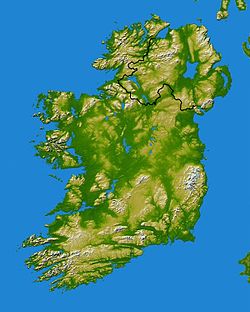
Laytown (An Inse en irlandais) est une ville du comté de Meath en République d'Irlande.
Laytown se situe à 47 km (29 miles) de la capitale Dublin.
Avec la ville voisine Bettystown, elle se situe sur un des plus fronts de mer les plus touristiques d’Irlande.
Une course de chevaux s’y tient annuellement sur la plage, et deux films y ont été tournés (The Crying Game et Michael Collins)
La ville de Laytown compte 2007 habitants.
Voir aussi
Wikimedia Foundation.
2010.
Contenu soumis à la licence CC-BY-SA. Source : Article Laytown de Wikipédia en français (auteurs)
Regardez d'autres dictionnaires:
Laytown — an Inse Town … Wikipedia
Laytown — Original name in latin Laytown Name in other language An Inse, Laytown State code IE Continent/City Europe/Dublin longitude 53.68194 latitude 6.23917 altitude 7 Population 6342 Date 2012 01 18 … Cities with a population over 1000 database
Laytown railway station — serves Laytown and Bettystown in County Meath, Ireland. The station opened on 25 May 1844 [cite web | title=Laytown and Bettystown station | work=Railscot Irish Railways | url=http://www.railscot.co.uk/Ireland/Irish railways.pdf | accessdate=2007 … Wikipedia
Laytown-Bettystown-Mornington — is a census town in County Meath, Ireland, comprising the adjoining villages of Laytown, Bettystown and Mornington. It had a population of 5597 at the 2002 census. The coastline stretches from the River Boyne, which borders County Louth to the… … Wikipedia
Bettystown — Infobox Irish Place name = Bettystown gaeilge = Baile an Bhiataigh crest motto = map pin coords = left: 112px; top: 51px north coord = 53.7014 west coord = 6.2461 irish grid = area = elevation = province = Leinster county = County Meath town pop … Wikipedia
Mornington, County Meath — Mornington Baile Uí Mhornáin Town … Wikipedia
Лейтаун (станция) — Координаты: 53°40′44.4″ с. ш. 6°14′32.27″ з. д. / 53.679° с. ш. 6.2423° з. д. … Википедия
County Meath — Contae na Mí Coat of arms Motto: Tré Neart … Wikipedia
Dublin Connolly railway station — Coordinates: 53°21′06″N 06°14′57″W / 53.35167°N 6.24917°W / 53.35167; 6.24917 … Wikipedia
Tabubil, Papua New Guinea — Infobox PNG Place type = town name = Tabubil province = wes llg = Star Mountains Rural district = North Fly dot x = 5 dot y = 65 caption = Tabubil aerial photograph, looking south over the town. The Kiunga Tabubil Highway can be seen on the left … Wikipedia


