Rankin Inlet
Contenu soumis à la licence CC-BY-SA. Source : Article Rankin Inlet de Wikipédia en français (auteurs)
Regardez d'autres dictionnaires:
Rankin Inlet — (en inuit Kangiqiniq) es la segunda ciudad más grande del territorio autónomo de Nunavut, en Canadá. Está ubicada en la isla de Baffin, en la parte occidental de la Bahía de Frobisher, al sureste de la isla. Su población actual se cifra en 2.189… … Wikipedia Español
Rankin Inlet — Inunnguaq (Inuksuk) als Wahrzeichen von Rankin Inlet … Deutsch Wikipedia
Rankin Inlet — Original name in latin Rankin Inlet Name in other language YRT State code CA Continent/City America/Rankin Inlet longitude 62.81732 latitude 92.08324 altitude 1 Population 2334 Date 2008 04 11 … Cities with a population over 1000 database
Rankin Inlet — Sp Ránkino įlanka Ap Rankin Inlet L Hadsono įl. dalis, Kanada (Nunavutas) … Pasaulio vietovardžiai. Internetinė duomenų bazė
Rankin Inlet Airport — Rankin Inlet Airport … Deutsch Wikipedia
Rankin Inlet North — is a territorial electoral district (riding) for the Legislative Assembly of Nunavut, Canada.The riding consists of the community of Rankin Inlet.The current Member of the Legislative Assembly is Tagak Curley.Election results1999… … Wikipedia
Rankin Inlet South/Whale Cove — is a territorial electoral district (riding) for the Legislative Assembly of Nunavut, Canada.The riding consists of the communities of Rankin Inlet and Whale Cove.The current Member of the Legislative Assembly is Levinia Brown.Election… … Wikipedia
Rankin Inlet, Nunavut — Infobox Settlement official name = Pagename other name = Kangiqiniq native name = ᑲᖏᕿᓂᖅ nickname = settlement type = Hamlet motto = imagesize = image caption = A Thule site at the Meliadine River near Rankin Inlet flag size = image seal size =… … Wikipedia
Rankin Inlet Airport — Infobox Airport name = Rankin Inlet Airport IATA = YRT ICAO = CYRT type = Public owner = operator = Government of Nunavut city served = location = Rankin Inlet, Nunavut elevation f = 94 elevation m = 28 coordinates =… … Wikipedia
Flughafen Rankin Inlet — Rankin Inlet Airport … Deutsch Wikipedia
 Canada
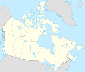
 Nunavut