Totteridge and Whetstone
- Totteridge and Whetstone
-
Totteridge and Whetstone (métro de Londres)
 Totteridge and Whetstone Totteridge and Whetstone |
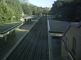
Les quais vus de l'entrée de la station |
| Localisation |
| District de Londres |
Barnet |
| Quartier |
Whetstone |
| Gestion et exploitation |
| Ligne |
 Northern Northern |
| Caractéristiques |
| Quais |
2 |
| Transit annuel |
1,443 millions (2004)
1,650 millions (2007) |
| Zone |
4 |
| Historique |
| Mise en service |
1872 |
Totteridge and Whetstone est une station du métro de Londres située au nord de la ville.
C'est l'avant-dernière station de la branche High Barnet de la Northern Line. Elle est située entre High Barnet et Woodside Park dans la zone 4 de la Travelcard.
Historique de la station
À ses tout débuts en 1872, elle est une simple station de la ligne Edgware, Highgate and London Railway, construite par la Great Northern Railway.
Caractéristiques
Cette section est vide, pas assez détaillée ou incomplète. Votre aide est la bienvenue !
Lieux remarquables
Cette section est vide, pas assez détaillée ou incomplète. Votre aide est la bienvenue !
Voir aussi
Liens internes
 Portail du chemin de fer
 Portail de Londres
 Portail des transports en commun
Catégorie : Northern line
Wikimedia Foundation.
2010.
Contenu soumis à la licence CC-BY-SA. Source : Article Totteridge and Whetstone de Wikipédia en français (auteurs)
Regardez d'autres dictionnaires:
Totteridge and Whetstone tube station — is a London Underground station in north London. The station is the penultimate one on the High Barnet branch of the Northern Line, between Woodside Park and High Barnet stations, and in Travelcard Zone 4. It is on the northern side of Totteridge … Wikipedia
Totteridge and Whetstone (metro de Londres) — Totteridge and Whetstone (métro de Londres) Totteridge and Whetstone Les quais vus de l entrée de la station Localisation … Wikipédia en Français
Totteridge and whetstone (métro de londres) — Totteridge and Whetstone Les quais vus de l entrée de la station Localisation … Wikipédia en Français
Totteridge and Whetstone (métro de Londres) — Totteridge and Whetstone Les quais vus de l entrée de la station Localisation District de … Wikipédia en Français
Totteridge — infobox UK place official name= Totteridge country = England map type = Greater London region= London population= latitude= 51.6354 longitude= 0.2000 constituency westminster= Chipping Barnet post town= LONDON postcode area= N postcode district=… … Wikipedia
Whetstone, London — infobox UK place country = England map type = Greater London region= London population= official name= Whetstone latitude= 51.6260 longitude= 0.1715 constituency westminster= Chipping Barnet post town= LONDON postcode area=N postcode district=… … Wikipedia
Edgware, Highgate and London Railway — Route of Edgware, Highgate London Railway highlighted on a 1900 map The Edgware, Highgate and London Railway was a railway in north London. The railway was a precursor of parts of London Underground s Northern Line and was, in the 1930s the core… … Wikipedia
Edgware, Highgate and London Railway — Legende … Deutsch Wikipedia
Charing Cross, Euston and Hampstead Railway — Hampstead tube redirects here. For Hampstead tube station, see Hampstead tube station. Geographic route map of Charing Cross, Euston Hampstead Railway The Charing Cross, Euston and Hampstead Railway (CCE HR), also known as the Hampstead tube, was … Wikipedia
City and South London Railway — A picture of a City South London Railway train from the Illustrated London News, 1890 The City and South London Railway (C SLR) was the first deep level underground tube railway in the world,[1][note 1 … Wikipedia
