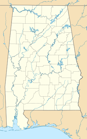
Dyas (Alabama)

Dyas (Alabama)

30° 57′ 45″ N 87° 40′ 34″ W / 30.9624050, -87.6760997

Dyas
Administration
Pays Drapeau des États-Unis États-Unis
État Alabama Alabama
Comté Baldwin
GNIS 0156290
Indicatif téléphonique local 251
Démographie
Population
Géographie
Coordonnées 30° 57′ 45″ Nord
       87° 40′ 34″ Ouest
/ 30.9624050, -87.6760997
Altitude 47 m
Superficie
Fuseau horaire CST (UTC-6)
Voir la carte administrative
City locator 14.svg
Voir la carte topographique
City locator 14.svg

Dyas est une communauté non-incorporée du comté de Baldwin (Alabama).

Elle fait partie de l'aire micropolitaine de Daphne–Fairhope–Foley.

Sommaire

Géographie

La communauté se trouve à une altitude moyenne de 47 mètres[1].

Climat

Relevé météorologique de la station la plus proche de Dyas
mois jan. fév. mar. avr. mai jui. jui. aoû. sep. oct. nov. déc. année
Température minimale moyenne (°C) 3,3 4,4 8,3 12,2 16,7 20 21,7 21,7 18,9 13,3 8,3 4,4 13
Température moyenne (°C) 8,9 11,1 14,4 18,3 22,2 25,6 26,7 26,7 24,4 18,9 14,4 10,6 18,5
Température maximale moyenne (°C) 15 17,2 21,1 24,4 28,3 31,1 31,7 31,7 29,4 25 20 16,1 24,3
Précipitations (mm) 158 130 168,1 121,2 150,4 142,7 210,1 152,4 146,3 78,2 131,6 129 1 718
Record de froid (°C)
(année du record)
-16,7
(21/01/1985)
-12,2
(03/02/1951)
-8,9
(03/03/1980)
-2,2
(04/04/1987)
5,6
(07/05/1992)
10,6
(01/06/1984)
6,1
(04/07/1964)
13,3
(14/08/2004)
5
(29/09/1967)
-0,6
(31/10/1993)
-7,2
(25/11/1950)
-13,9
(24/12/1989)
-16,7
Record de chaleur (°C)
(année du record)
29,4
(11/01/1949)
28,9
(27/02/1962)
31,1
(15/03/1967)
33,9
(22/04/1987)
37,8
(31/05/1951)
40,6
(14/06/1963)
39,4
(14/07/1980)
40
(12/08/2007)
38,9
(10/09/1954)
35,6
(05/10/1954)
30
(04/11/1973)
27,8
(02/12/1982)
40,6
Source : Yahoo! Météo


Sources

Références

Compléments

Liens externes


Wikimedia Foundation. 2010.

Contenu soumis à la licence CC-BY-SA. Source : Article Dyas (Alabama) de Wikipédia en français (auteurs)

Игры ⚽ Нужен реферат?

Regardez d'autres dictionnaires:

  • Dyas Hexagonal Barn — U.S. National Register of Historic Places …   Wikipedia

  • Comté de Baldwin (Alabama) — 30°43′59″N 87°43′13″O / 30.73306, 87.72028 …   Wikipédia en Français

  • Auburn Tigers football — Auburn Tigers Current season …   Wikipedia

  • Mid-November 2006 tornado outbreak — Date of tornado outbreak: November 15 16, 2006 Duration1: 27 hours, 47 minutes Maximum rated tornado2: F3 tornado Tornadoes caused: 28 confirmed Damages: $10.5 million (NCDC figures) …   Wikipedia

  • National Register of Historic Places listings in Jackson County, Iowa — Location of Jackson County in Iowa This is a list of the National Register of Historic Places listings in Jackson County, Iowa. This is intended to be a complete list of the properties and districts on the National Register of Historic Places in… …   Wikipedia

  • Joe Namath — Namath in 2003 No. 12      Quarterback Personal information Date of birth: May 31, 1943 …   Wikipedia

  • Dwight Stephenson — No. 57      Center Personal information Date of birth: November 20, 1957 (1957 11 20) (age 53) Murfreesboro, North Carolina …   Wikipedia

  • Cornelius Griffin — in 2007. No.       Free Agent Defensive tackle Personal information Date of birth: D …   Wikipedia

  • Cornelius Bennett — Position(s) Linebacker Jersey #(s) 55, 97 Born August 25, 1965 (1965 08 25) (age 46) Birmingham, Alabama Career information …   Wikipedia

  • Archie Manning — No. 4, 8      Quarterback Personal information Date of birth: May 19, 1949 (1949 05 19) (age 62) Place of birth: Drew, Mississippi …   Wikipedia

Share the article and excerpts

Direct link
Do a right-click on the link above
and select “Copy Link”