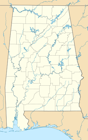
Gulf Highlands (Alabama)
Contenu soumis à la licence CC-BY-SA. Source : Article Gulf Highlands (Alabama) de Wikipédia en français (auteurs)
Regardez d'autres dictionnaires:
Gulf Coastal Plain — The Gulf Coastal Plain extends from the Florida Parishes of Louisiana over most of Mississippi, some of western Tennessee and Kentucky, the southwestern 2/3 of Alabama, and the western panhandle of Florida and Southern Texas. Its southern… … Wikipedia
Comté de Baldwin (Alabama) — 30°43′59″N 87°43′13″O / 30.73306, 87.72028 … Wikipédia en Français
Geography of Alabama — Physical featuresExtending entirely across the state of Alabama for about convert|20|mi|km|0 south of its northern boundary, and in the middle stretching convert|60|mi|km|0 farther south, is the Cumberland Plateau, or Tennessee Valley region,… … Wikipedia
Geology of Alabama — The geology of Alabama is marked by abundant geologic resources and a variety of geologic structures from folded mountains in the north to sandy beaches along the Gulf of Mexico coast. Alabama spans three continental geologic provinces as defined … Wikipedia
Climate of Alabama — Worldwide climate classifications The state is classified as humid subtropical (Cfa) under the Koppen Climate Classification.[1] The average annual temperature is 64 °F (18 °C). Temperatures tend to be warmer in the southern part of the … Wikipedia
Tuscaloosa County, Alabama — Infobox U.S. County county = Tuscaloosa County state = Alabama map size = 175 founded = February 6, 1818 seat = Tuscaloosa largest city = Tuscaloosa area total sq mi =1351 area land sq mi =1324 area water sq mi =27 area percentage = 1.99% census… … Wikipedia
List of Florida railroads — Contents 1 Current railroads 1.1 Common freight carriers 1.2 Private freight carriers … Wikipedia
Florida Panhandle — For a list of other U.S. states with similar geographic extensions, see Panhandle Map showing Florida counties that may be included in references to the Panhandle; the eastern extent of the Panhandle is arbitrarily defined and may vary … Wikipedia
GAQ — Diese Teilliste führt alle IATA Flughafen Codes auf, die mit „G“ beginnen, und enthält Informationen zu den bezeichneten Verkehrsknotenpunkten. IATA Codes A B C D E F G H I … Deutsch Wikipedia
Liste der IATA-Codes/G — Diese Teilliste führt alle IATA Flughafen Codes auf, die mit „G“ beginnen, und enthält Informationen zu den bezeichneten Verkehrsknotenpunkten. IATA Codes A B C D E F G H I J K L M N O P Q … Deutsch Wikipedia
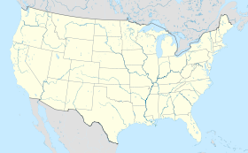
 États-Unis
 Alabama