- Nantucket Shoals
-
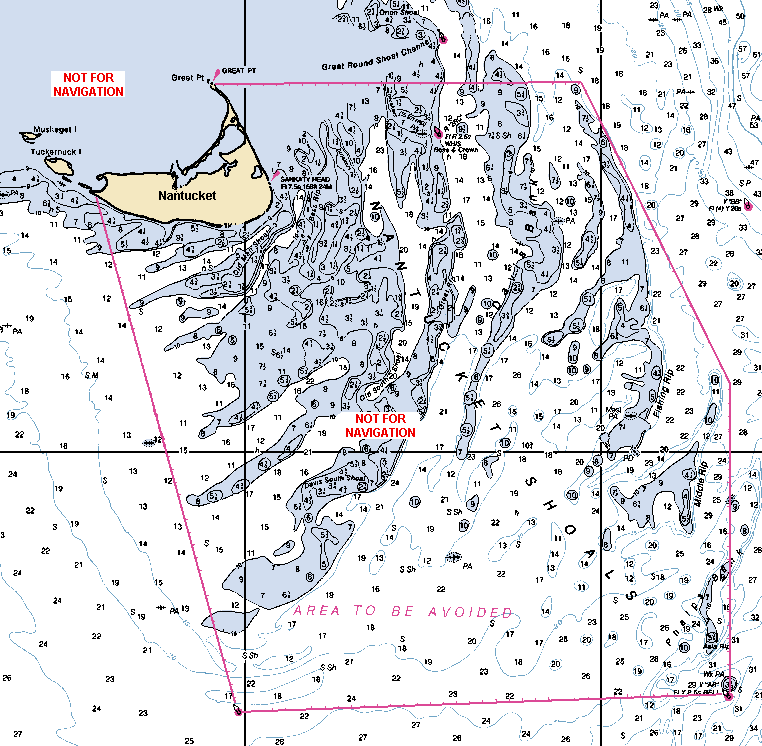
 Détail de la carte marine de la NOAA montrant les Nantucket Shoals en ce qui concerne l'île de Nantucket.
 Le pétrolier Argo Merchant échoué dans la Middle Rip, le 15 décembre 1976.
Les Nantucket Shoals (« hauts-fonds de Nantucket » en français) sont une zone marine d'une profondeur dangereusement faible et située dans l'océan Atlantique depuis l'île de Nantucket (Massachusetts) vers l'est sur 37 km et vers le sud-est sur 64 km. La profondeur peut être par endroits aussi faible que de 91 cm ; la profondeur exacte en tout point reste imprévisible car en constant changement à cause des forts courants. Ces hauts-fonds se trouvent juste à côté d'une grande voie de navigation transatlantique. De nombreux navires y ont fait naufrage, notamment le pétrolier Argo Merchant en décembre 1976. Jusqu'en 1983, la frontière de la zone était surveillé par le phare de Nantucket.
Les Nantucket Shoals sont découpés selon les zones suivantes :
- Asia Rip
- Davis Bank
- Fishing Rip
- Middle Rip
- Phelps Bank
Selon l'édition 2010 de l'ouvrage United States Coast Pilots édité par l'Organisation maritime internationale une « zone à éviter » a été établie dans ces hauts-fonds. Les navires pétroliers ou transportant des matières dangereuses et les navires de plus de 1 000 tonnes doivent éviter la zone délimitée par les six points délimitant l'hexagone rode de la carte ci-contre.
Notes et références
- (en) Cet article est partiellement ou en totalité issu de l’article de Wikipédia en anglais intitulé « Nantucket Shoals » (voir la liste des auteurs)
 Portail du Massachusetts
 Portail du monde maritime
Catégories :- Nantucket (Massachusetts)
- Modelé des États-Unis

Wikimedia Foundation. 2010.