Plískov
- Plískov
-
Plískov est un village du district de Rokycany dans la région de Plzeň en Tchéquie. La municipalité possède une superficie de 3,33 km², et une population de 121 habitants (recensé en juillet 2006). Plískov est situé à environ 16 kilomètres au nord-ouest de Rokycany, à 28 km à l'est de Plzeň, et à 57 km au sud-ouest de Prague.
Lien externe
Wikimedia Foundation.
2010.
Contenu soumis à la licence CC-BY-SA. Source : Article Plískov de Wikipédia en français (auteurs)
Regardez d'autres dictionnaires:
Pliskov — may refer to:* Pliska, a small village, and the historical capital of Bulgaria * Plyskiv, Ukraine, a village in Vinnytsia Oblast, Ukraine … Wikipedia
Plyskiv, Ukraine — Plyskiv ( uk. Плисків, ru. Плискoв) is a village in Vinnytsia Oblast, Ukraine. The population is 1,439 (2006). Pliskov History Pliskov was first mentioned in Polish archive documents in 1552. Pliskov was settled on the banks of the river Rosen,… … Wikipedia
District de Rokycany — Okres Rokycany (cs) Administration … Wikipédia en Français
Pliska — For the ancient battle, see Battle of Pliska Pliska ( bg. Плиска) is the name of both the first capital of Danubian Bulgaria and a small town (formerly village known as Aboba) which was renamed after the historical Pliska after its site was… … Wikipedia
List of German exonyms for places in the Czech Republic — Below are links to subpages with more detailed listings of the German language names of towns and villages in different regions of the Czech Republic. Many of these German names are now exonyms, but used to be endonyms commonly used by the local… … Wikipedia
Zbiroh — Geobox Town name = Zbiroh native name = other name = other name1 = category = Town image size = image caption = flag size = symbol = symbol size = country = Czech Republic state = region = Pilsen district = Rokycany district type = Little… … Wikipedia
Rokycany District — Okres Rokycany District … Wikipedia
Mirošov — Coordinates: 49°41′33″N 13°39′41″E / 49.6925°N 13.66139°E / 49.6925; 13.66139 … Wikipedia
Mýto — Coordinates: 49°47′21″N 13°44′06″E / 49.78917°N 13.735°E / 49.78917; 13.735 … Wikipedia
List of villages and towns depopulated of Jews during the Holocaust — Below is a list of villages and towns depopulated of Jews during the Holocaust carried out under the Nazi regime during 1940 1945:Belarus*Antopol *Berezino *Chavusy *Davyd Haradok *Hrodna *Ivye *Lakhva *Lyubavichi *Luniniec *Minsk *Motol *Obech,… … Wikipedia
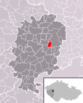 Localisation dans le District de Rokycany.
 République tchèque
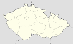
 Plískov
