Štítov
Contenu soumis à la licence CC-BY-SA. Source : Article Štítov de Wikipédia en français (auteurs)
Regardez d'autres dictionnaires:
District de Rokycany — Okres Rokycany (cs) Administration … Wikipédia en Français
Rokycany — Geobox | Settlement name = Rokycany other name = category = Town image caption = Town Hall | flag border = 1 symbol = Rokycany CoA CZ.png etymology = official name = motto = nickname = country = Czech Republic country state = region = Plzeň… … Wikipedia
Blovice — Geobox | Settlement name = Blovice other name = category = Town image caption = symbol = Blovice znak.png etymology = official name = motto = nickname = country = Czech Republic country state = region = Plzeň | region type = Region district =… … Wikipedia
Kriváň (peak) — Geobox|Mountain name = Kriváň native name = other name = category = etymology = angled nickname = country = Slovakia country state = region = Prešov district = Poprad municipality = range = High Tatras location = elevation = 2495 prominence = lat … Wikipedia
Rokycany District — Okres Rokycany District … Wikipedia
Ludwig Greiner — Infobox Person name = Ludwig Greiner image size = caption = birth name = Ludwig Greiner birth date = 1796 birth place = Lichtentanne, Saxony death date = 28 October 1882 (aged 86) death place = Jelšava death cause = resting place = Jelšava,… … Wikipedia
Mirošov — Coordinates: 49°41′33″N 13°39′41″E / 49.6925°N 13.66139°E / 49.6925; 13.66139 … Wikipedia
Mýto — Coordinates: 49°47′21″N 13°44′06″E / 49.78917°N 13.735°E / 49.78917; 13.735 … Wikipedia
Osek (Rokycany District) — Osek Municipality Flag … Wikipedia
Aujest beim Heiligenkreuz — Újezd u Svatého Kříže … Deutsch Wikipedia
 République tchèque
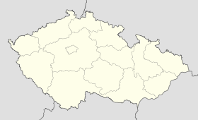
 Štítov