Provodín

Provodín
Provodín
Administration
Pays Drapeau de République tchèque République tchèque
District Česká Lípa
Région région de Liberec
Code postal 471 67
Géographie
Coordonnées 50° 37′ 23″ Nord
       14° 36′ 02″ Est
/ 50.62306, 14.60056
Altitude 263 m
Superficie 1 258 ha = 12,58 km2
Démographie
Population 681 hab.
Densité 54,1 hab./km2
Localisation
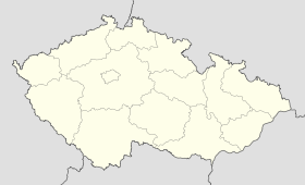
Czech Republic location map.svg
City locator 14.svg
Provodín

Provodín est un village du district de Česká Lípa dans la région de Liberec en République tchèque.

Histoire


Wikimedia Foundation. 2010.

Contenu soumis à la licence CC-BY-SA. Source : Article Provodín de Wikipédia en français (auteurs)

Игры ⚽ Поможем сделать НИР

Regardez d'autres dictionnaires:

  • Provodín — Provodín …   Deutsch Wikipedia

  • Provodín — is a small town in Czech Republic near to Liberec. It is located in Česká Lípa district. External links * [http://www.obec provodin.cz/ Official site] …   Wikipedia

  • Mickenhan — Provodín …   Deutsch Wikipedia

  • Habstein — Jestřebí …   Deutsch Wikipedia

  • Česká Lípa — Coordinates: 50°41′19″N 14°32′19″E / 50.68861°N 14.53861°E / 50.68861; 14.53861 …   Wikipedia

  • Jestřebí u České Lípy — Jestřebí …   Deutsch Wikipedia

  • Česká Lípa District — Okres Česká Lípa   District   Česká Lípa town …   Wikipedia

  • Bad Hammer am See — Hamr na Jezeře …   Deutsch Wikipedia

  • Bezdez — Bezděz …   Deutsch Wikipedia

  • Bezirk Böhmisch Leipa — Lage des Okres Česká Lípa Der Okres Česká Lípa (Bezirk Böhmisch Leipa) befindet sich in Nordböhmen und liegt zwischen dem Böhmischen Mittelgebirge, Jeschkengebirge und Böhmischen Paradies. Er gehört zum Liberecký kraj (Region Reichenberg). (Zur… …   Deutsch Wikipedia

Share the article and excerpts

Direct link
Do a right-click on the link above
and select “Copy Link”