McArthur-Burney Falls Memorial State Park
- McArthur-Burney Falls Memorial State Park
-
McArthur-Burney Falls Memorial State Park
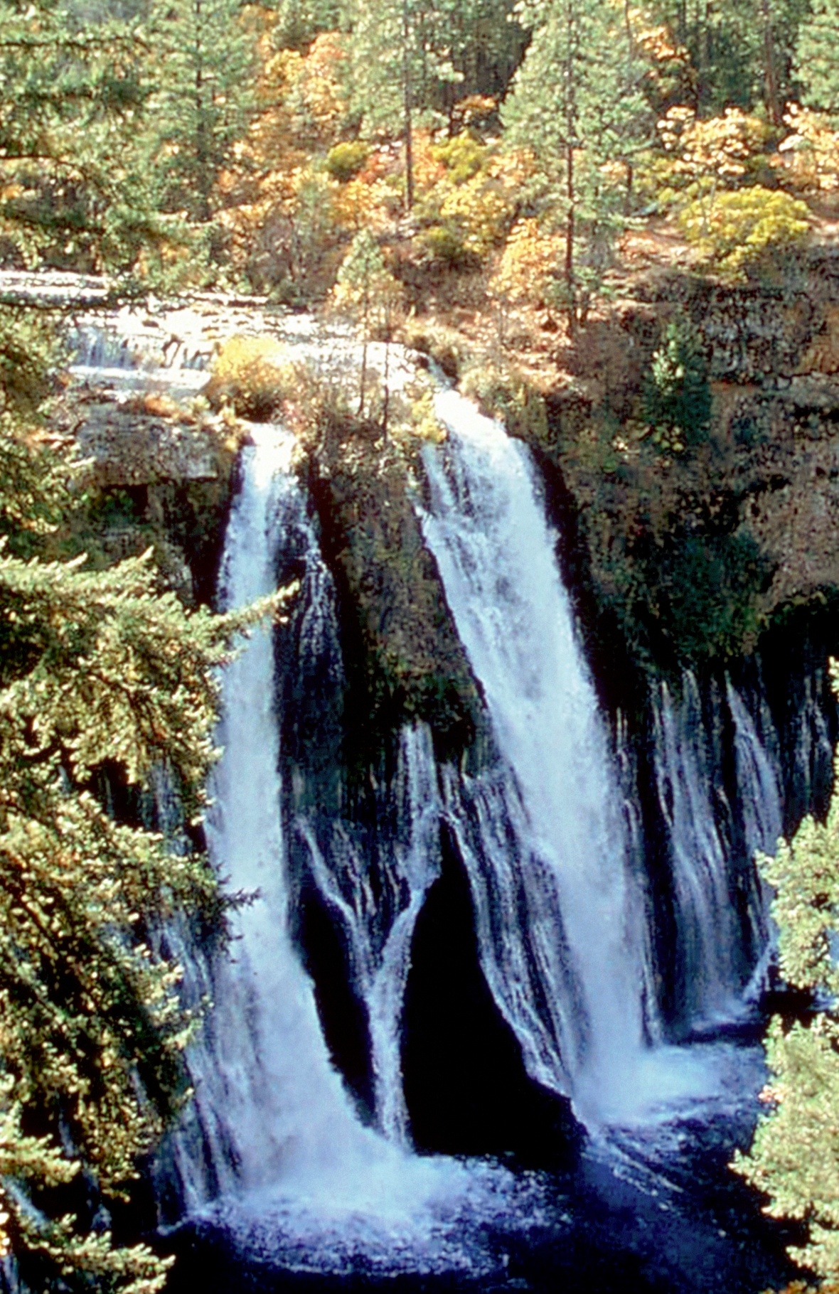
Situé à environ 10 km au nord du Burney, McArthur-Burney Falls Memorial State Park est le second plus ancien parc d'État de Californie. Le parc offre des facilités pour le camping, la pêche, les sports nautiques, la randonnée et l'équitation. Le parc est principalement connu pour ses chutes d'eau, les Burney Falls, à l'entrée de celui-ci.
 Portail de la conservation de la nature
 Portail des États-Unis
Catégories : Californie | Pacific Crest Trail
Wikimedia Foundation.
2010.
Contenu soumis à la licence CC-BY-SA. Source : Article McArthur-Burney Falls Memorial State Park de Wikipédia en français (auteurs)
Regardez d'autres dictionnaires:
McArthur-Burney Falls Memorial State Park — Location Shasta County, California … Wikipedia
Burney Falls — This article is about the waterfall, Burney Falls. For the state park, see McArthur Burney Falls Memorial State Park. Burney Falls is a waterfall on Burney Creek, in McArthur Burney Falls Memorial State Park, Shasta County, California. The water… … Wikipedia
Donner Memorial State Park — Donner Camp U.S. National Register of Historic Places U.S. National Historic Landmark … Wikipedia
Ahjumawi Lava Springs State Park — is a state park located in Shasta County, California. The state acquired the land from the Horr Ranch in 1975. [ The Intermountain News, Burney, Ca. Aug.14, 2002 p.3.] This park is unique in the California state park system because public access… … Wikipedia
Letchworth State Park — is a New York state park located 35 miles (56 km) south of Rochester and 60 miles (95 km) east of Buffalo in Livingston and Wyoming Counties. The park is roughly 17 miles (24 km) long, [http://www.cnn.com/2006/TRAVEL/DESTINATIONS/08/07/mini.grand … Wikipedia
Del Norte Coast Redwoods State Park — IUCN Category II (National Park) Location Del Norte County, California, USA Nearest c … Wikipedia
State Parks in Kalifornien — Dies ist die Liste der State Parks im US Bundesstaat Kalifornien. Im Juni 2009 gab es in Kalifornien 279 State Parks deren Unterhalt sich auf 143 Millionen US Dollar beläuft. 2008 konnten 80 Millionen State Park Besucher gezählt werden, die ein… … Deutsch Wikipedia
Burney, California — Infobox Settlement official name = Burney, California settlement type = CDP imagesize = image caption = image imagesize = image caption = image mapsize = 250x200px map caption = Location in Shasta County and the state of California mapsize1 = map … Wikipedia
The Forest of Nisene Marks State Park — Redwood trees in the Forest of Nisene Marks. The Forest of Nisene Marks is a State Park located in Aptos, California and contains over 40 miles (64 km) of hiking trails and fire roads through approximately 10,000 acres (40 km2) of… … Wikipedia
Henry W. Coe State Park — IUCN Category V (Protected Landscape/Seascape) Location Santa Clara and Stanislaus counties, California, USA Nearest … Wikipedia
 Burney Falls