Darpas
- Darpas
-
40° 50′ 17″ N 44° 25′ 24″ E / 40.838056, 44.423333
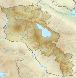
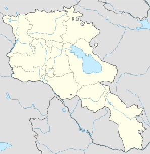
Darpas (en arménien Դարպաս) est une communauté rurale du marz de Lorri en Arménie. En 2008, elle compte 1 800 habitants[2].
Notes et références
- ↑ (hy+en) Central Electoral Commission of the Republic of Armenia. Consulté le 24 janvier 2011.
Pour obtenir la page en anglais, cliquez sur le drapeau arménien en haut à gauche, et sélectionnez « English » ; ensuite, dans le menu vertical de gauche, cliquez sur « Local », sélectionnez le
marz pertinent, puis la dernière élection correspondant à la communauté voulue.
- ↑ (en) ArmStat, Marzes of the Republic of Armenia in figures, 2008, « RA Lori Marz », 2008. Consulté le 20 septembre 2009.
Wikimedia Foundation.
2010.
Contenu soumis à la licence CC-BY-SA. Source : Article Darpas de Wikipédia en français (auteurs)
Regardez d'autres dictionnaires:
Darpas — Coordinates: 40°50′17″N 44°25′24″E / 40.83806°N 44.42333°E / 40.83806; 44.42333 … Wikipedia
Darpas — Original name in latin Darpas Name in other language Darbas, Darpas, Дарпас State code AM Continent/City Asia/Yerevan longitude 40.83674 latitude 44.42494 altitude 1377 Population 1785 Date 2012 01 17 … Cities with a population over 1000 database
Championnat d'Arménie de baseball — Infobox compétition sportive Championnat d Arménie de baseball Création 1994 Organisateur(s) ABL Catégorie Division 1 Lieu … Wikipédia en Français
Odzun — Օձուն … Wikipedia
Vanadzor — Seal … Wikipedia
Melik — For the village formerly named Melik in Greece, see Meliki. Five principalities of Karabakh (Gyulistan, Jaraberd, Khachen, Varand, Dizaq), the last relict of Armenian statehood (16th century) … Wikipedia
Akhtala — For the town in Kotayk Province, see Hrazdan; for the nearby town sometimes also called Akhtala, see Verin Akhtala. Coordinates: 41°08′N 44°46′E / 41.133°N 44.767°E … Wikipedia
Sempad the Constable — This article is about the 13th century Cilician noble. For other uses, see Smbat. A 14th century copy of the February 7, 1248, letter of Sempad to Henry I of Cyprus and John of Ibelin, stating that If God hadn t brought the Tartars who then… … Wikipedia
Arevashogh — Coordinates: 40°51′41″N 44°16′22″E / 40.86139°N 44.27278°E / 40.86139; 44.27278 … Wikipedia
Jrashen — For other places with the same name, see Jrashen (disambiguation). Jrashen Ջրաշեն … Wikipedia
 Arménie