Kurtan
- Kurtan
-
40° 57′ 43″ N 44° 33′ 59″ E / 40.961944, 44.566389
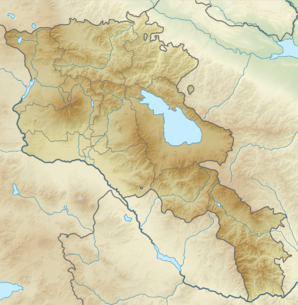
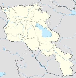
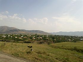
Kurtan (en arménien Կուրթան) est une communauté rurale du marz de Lorri en Arménie. En 2008, elle compte 2 307 habitants[2].
Notes et références
- ↑ (hy+en) Central Electoral Commission of the Republic of Armenia. Consulté le 24 janvier 2011.
Pour obtenir la page en anglais, cliquez sur le drapeau arménien en haut à gauche, et sélectionnez « English » ; ensuite, dans le menu vertical de gauche, cliquez sur « Local », sélectionnez le
marz pertinent, puis la dernière élection correspondant à la communauté voulue.
- ↑ (en) ArmStat, Marzes of the Republic of Armenia in figures, 2008, « RA Lori Marz », 2008. Consulté le 22 septembre 2009.
Sur les autres projets Wikimedia :
Wikimedia Foundation.
2010.
Contenu soumis à la licence CC-BY-SA. Source : Article Kurtan de Wikipédia en français (auteurs)
Regardez d'autres dictionnaires:
Kurtan — Infobox Settlement official name =Kurtan Կուրթան native name = pushpin mapsize =150px subdivision type = Country subdivision name = Armenia subdivision type1 = Marz (Province) subdivision name1 =Lori leader title = leader name = established title … Wikipedia
KURTAN — … Википедия
KURTAN — At ın arkasına vurdukları keçe … Yeni Lügat Türkçe Sözlük
Dzoraget River — Infobox River river name = Dzoraget Ձորագետ caption = The Dzoraget River as seen from the bridge in Stepanavan origin = Bazum Mountains, Lori, Armenia mouth = Debed River Near Dzoragyukh basin countries = Armenia length = elevation = 2,200 m… … Wikipedia
Hobardz — Hobardzi Հոբարձի Panorama of Hobardzi from the main road into the village … Wikipedia
Hnevank — Le monastère vu depuis le sud est. Présentation Nom local (hy) Հնեվանք … Wikipédia en Français
Odzun — Օձուն … Wikipedia
Heck reaction — The Heck reaction (also called the Mizoroki Heck reaction)[1] is the chemical reaction of an unsaturated halide (or triflate) with an alkene and a base and palladium catalyst to form a substituted alkene.[2][3] Together with the other palladium… … Wikipedia
Vanadzor — Seal … Wikipedia
Akhtala — For the town in Kotayk Province, see Hrazdan; for the nearby town sometimes also called Akhtala, see Verin Akhtala. Coordinates: 41°08′N 44°46′E / 41.133°N 44.767°E … Wikipedia
 Arménie