Héreg
- Héreg
-
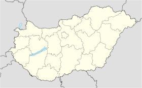
Héreg est un village et une commune du comitat de Komárom-Esztergom en Hongrie.
Géographie
Cette section est vide, insuffisamment détaillée ou incomplète.
Votre aide est la bienvenue !
Histoire
Cette section est vide, insuffisamment détaillée ou incomplète.
Votre aide est la bienvenue !
Catégorie :
- Ville et village du comitat de Komárom-Esztergom
Wikimedia Foundation.
2010.
Contenu soumis à la licence CC-BY-SA. Source : Article Héreg de Wikipédia en français (auteurs)
Regardez d'autres dictionnaires:
Héreg — Infobox Settlement subdivision type = Country subdivision name = HUN timezone=CET utc offset=+1 timezone DST=CEST utc offset DST=+2|official name=Héreg subdivision type1=County subdivision name1=Komárom Esztergom area total km2=27.13 population… … Wikipedia
hereg- — see herg , herig … Old to modern English dictionary
Capital and corporal punishment in Judaism — The Jewish tradition describes certain forms of corporal punishment and capital punishment for certain crimes, while cautioning against the use of such punishments. Contents 1 Capital punishment in classical sources 1.1 Stringencies of Evidence… … Wikipedia
Corporal punishment (Judaism) — The Torah describes certain forms of corporal punishment for certain sins and crimes.TypesThe four types of capital punishment, known as mitath beth din (execution by the rabbinic court), were: * Sekila stoning * Serefah burning * Hereg… … Wikipedia
Komárom-Esztergom County — Infobox Hungarian county name =Komárom Esztergom region =Central Transdanubia seat = Tatabánya area = 2265 population = 319,000 density = 142 cities = 76Komárom Esztergom is the name of an administrative county (comitatus or megye) in northern… … Wikipedia
Tatabánya — Infobox Settlement image caption = County hall image shield = Tatabánya címere új.jpg subdivision type = Country subdivision name = HUN timezone=CET utc offset=+1 timezone DST=CEST utc offset DST=+2 pushpin pushpin label position = pushpin map… … Wikipedia
Oroszlány — Aerial view … Wikipedia
Dorog — Town … Wikipedia
Nyergesújfalu — Nyergesújfalu … Wikipedia
HU-TB — Tatabánya Landkarte Stadtwappen Basisdaten Staa … Deutsch Wikipedia


 Hongrie
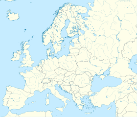

 Héreg
Héreg


